Al Qadarif geodata
Al Qadarif (Al Qaḑārif) is a seat of a first-order administrative division; located in Sudan in Africa/Khartoum (GMT+2) time zone. With population of 363,945 people, there are 6 cities with bigger population in this country. Compared to other cities in Sudan, 54.9% of cities are located further ↓South; 88.7% of cities are located further ←West and 87.3% of cities have lower elevation than Al Qadarif. Note1


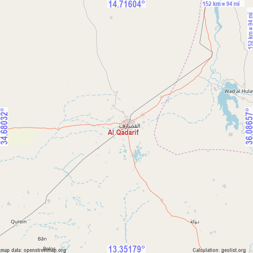
Al Qadarif GPS coordinates[2]
14° 2' 5.748" North, 35° 23' 0.384" East
| Map corner | latitude | longitude |
|---|---|---|
| Upper-left | 14.71604°, | 34.68032° |
| Center: | 14.03493°, | 35.38344° |
| Lower-right: | 13.35179°, | 36.08657° |
| Map W x H: | 151.7×151.7 km | = 94.3×94.3mi |
| max Lat: | 21.06667° ⇑45.1% North |
| Al Qadarif: | 14.03493° |
| min Lat: | ⇓54.9% South 10.55° |
| min Long | Al Qadarif | max Long |
| 22.44725° | 35.38344° | 37.729° |
| W 88.7%⇐ | ⇒11.3% E |
Elevation
Elevation of Al Qadarif is 608 m = 1995 ft, and this is 158.9 m = 521 ft above average elevation for this country.
| Max E: |
1159 m = 3802 ft | 12.7% |
| Al Qadarif | 608 m 1995 ft | |
| Avg. | 449.1 m = 1473 ft | |
Min E: |
4 m = 13 ft | 87.3% |
See also: Al Qadarif elevation on elevation.city.
Geographical zone
Al Qadarif is located in North Torrid zone (between Equator and Tropic of Cancer). Distance of this Northern Tropic circle is 1045.4 km =649.6 mi to North.| Distance of | km | miles | from Al Qadarif |
|---|---|---|---|
| North Pole | 8446.5 | 5248.4 | to North |
| Arctic Circle | 5840.6 | 3629.2 | to North |
| Tropic Cancer | 1045.4 | 649.6 | to North |
| Equator | 1560.5 | 969.6 | to South |


Nearby cities:
15 places around Al Qadarif: (largest is in red/bold)
• Ad Dindar
161 km =100 mi,  234°
234°
• Al Hasaheisa
238.3 km =148.1 mi,  289°
289°
• Al Masallamiyya
228.5 km =142 mi, 285°
• Al Ḩawātah
106.3 km =66.1 mi, 229°
• Aroma
213.9 km =132.9 mi,  22°
22°
• As Sūkī
180.7 km =112.3 mi,  243°
243°
• Doka
70.9 km =44.1 mi,  144°
144°
• Jalqani
216.8 km =134.7 mi,  215°
215°
• Kassala
191.7 km =119.1 mi,  34°
34°
• Kināna
238.6 km =148.3 mi,  270°
270°
• Maiurno
197.8 km =122.9 mi,  249°
249°
• Singa
185.3 km =115.1 mi, 237°
• Sinnar
202.8 km =126 mi,  255°
255°
• Wad Medani
204.9 km =127.3 mi,  281°
281°
• Wagar
251.4 km =156.2 mi, 20°
In other languages:
- In Spanish: Gadarif
- In France: Al-Qadarif
- In German: Al-Qadarif
- In Italian: Gadaref
- In Russian: Гедареф
- In Chinese: 加达里夫
Sources, notices
• [Note1] Compared only with cities in Sudan existing in our database
• [Src1] Map data: © OpenStreetMap contributors (CC-BY-SA)
• [Src2] Other city data from geonames.org with taken over terms of usage.
• [Src3] Geographical zone / Annual Mean Temperature by Robert A. Rohde @ Wikipedia
