Wagar geodata
Wagar (Kassala) is a populated place; located in Sudan in Africa/Khartoum (GMT+2) time zone. With population of 11,950 people, there are 52 cities with bigger population in this country. Compared to other cities in Sudan, 77.5% of cities are located further ↓South; 93% of cities are located further ←West and 54.9% of cities have higher elevation than Wagar. Note1


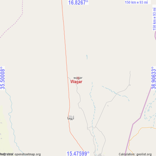
Wagar GPS coordinates[2]
16° 9' 9" North, 36° 12' 11.52" East
| Map corner | latitude | longitude |
|---|---|---|
| Upper-left | 16.8267°, | 35.50008° |
| Center: | 16.1525°, | 36.2032° |
| Lower-right: | 15.47599°, | 36.90633° |
| Map W x H: | 150.2×150.2 km | = 93.3×93.3mi |
| max Lat: | 21.06667° ⇑22.5% North |
| Wagar: | 16.1525° |
| min Lat: | ⇓77.5% South 10.55° |
| min Long | Wagar | max Long |
| 22.44725° | 36.2032° | 37.729° |
| W 93%⇐ | ⇒7% E |
Elevation
Elevation of Wagar is 421 m = 1381 ft, and this is 28.1 m = 92 ft below average elevation for this country.
| Max E: |
1159 m = 3802 ft | 54.9% |
| Avg. | 449.1 m = 1473 ft | |
| Wagar | 421 m = 1381 ft | |
Min E: |
4 m = 13 ft | 45.1% |
See also: Sudan elevation on elevation.city.
Geographical zone
Wagar is located in North Torrid zone (between Equator and Tropic of Cancer). Distance of this Northern Tropic circle is 809.9 km =503.2 mi to North.| Distance of | km | miles | from Wagar |
|---|---|---|---|
| North Pole | 8211.1 | 5102.1 | to North |
| Arctic Circle | 5605.2 | 3482.9 | to North |
| Tropic Cancer | 809.9 | 503.2 | to North |
| Equator | 1796 | 1116 | to South |


Nearby cities:
15 places around Wagar: (largest is in red/bold)
• Al Hilāliyya
345.5 km =214.7 mi,  247°
247°
• Al Qadarif
251.4 km =156.2 mi,  200°
200°
• Al Ḩawātah
347.9 km =216.2 mi,  209°
209°
• Aroma
38.1 km =23.7 mi,  191°
191°
• Atbara
292 km =181.4 mi,  306°
306°
• Berber
314.4 km =195.4 mi, 311°
• Doka
296.8 km =184.4 mi, 189°
• Ed Damer
286.7 km =178.1 mi,  304°
304°
• El Bauga
338.3 km =210.2 mi, 313°
• El Matama
309.8 km =192.5 mi,  281°
281°
• Kassala
80.8 km =50.2 mi,  164°
164°
• Shendi
301.4 km =187.3 mi, 281°
• Tokār
300.2 km =186.5 mi,  32°
32°
• Wad Medani
347.5 km =215.9 mi,  235°
235°
• Wad Rāwah
346 km =215 mi, 251°
Sources, notices
• [Note1] Compared only with cities in Sudan existing in our database
• [Src1] Map data: © OpenStreetMap contributors (CC-BY-SA)
• [Src2] Other city data from geonames.org with taken over terms of usage.
• [Src3] Geographical zone / Annual Mean Temperature by Robert A. Rohde @ Wikipedia
