Bindi geodata
Bindi (Northern Province) is a populated place; located in Sierra Leone in Africa/Freetown (GMT+0) time zone. With population of 3,188 people, there are 72 cities with bigger population in this country. Compared to other cities in Sierra Leone, 100% of cities are located further ↓South; 61.4% of cities are located further ←West and 86.7% of cities have lower elevation than Bindi. Note1


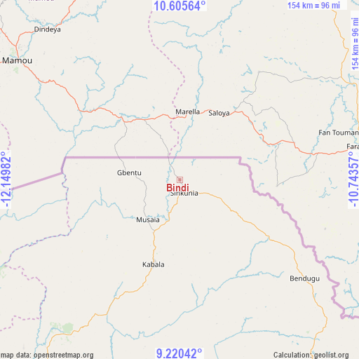
Bindi GPS coordinates[2]
9° 54' 49.536" North, 11° 26' 48.084" West
| Map corner | latitude | longitude |
|---|---|---|
| Upper-left | 10.60564°, | -12.14982° |
| Center: | 9.91376°, | -11.44669° |
| Lower-right: | 9.22042°, | -10.74357° |
| Map W x H: | 154×154 km | = 95.7×95.7mi |
| max Lat: | 9.91376° ⇑0% North |
| Bindi: | 9.91376° |
| min Lat: | ⇓100% South 7.24611° |
| min Long | Bindi | max Long |
| -13.28972° | -11.44669° | -10.37135° |
| W 61.4%⇐ | ⇒38.6% E |
Elevation
Elevation of Bindi is 379 m = 1243 ft, and this is 221.8 m = 728 ft above average elevation for this country.
| Max E: |
564 m = 1850 ft | 13.3% |
| Bindi | 379 m 1243 ft | |
| Avg. | 157.2 m = 516 ft | |
Min E: |
1 m = 3 ft | 86.7% |
See also: Sierra Leone elevation on elevation.city.
Geographical zone
Bindi is located in North Torrid zone (between Equator and Tropic of Cancer). Distance of Equator is 1102.3 km =684.9 mi to South.| Distance of | km | miles | from Bindi |
|---|---|---|---|
| North Pole | 8904.8 | 5533.2 | to North |
| Arctic Circle | 6298.9 | 3914 | to North |
| Tropic Cancer | 1503.6 | 934.3 | to North |
| Equator | 1102.3 | 684.9 | to South |


Nearby cities:
15 places around Bindi: (largest is in red/bold)
• Alikalia
84.8 km =52.7 mi,  175°
175°
• Binkolo
121.9 km =75.7 mi,  208°
208°
• Bumbuna
102 km =63.4 mi,  198°
198°
• Gberia Fotombu
31.1 km =19.3 mi,  97°
97°
• Kabala
37.9 km =23.5 mi, 197°
• Kamakwie
98.6 km =61.3 mi,  241°
241°
• Kayima
118.3 km =73.5 mi,  164°
164°
• Koyima
142.2 km =88.4 mi, 160°
• Loma
66.6 km =41.4 mi,  255°
255°
• Magburaka
143.4 km =89.1 mi, 202°
• Makeni
131.7 km =81.8 mi, 209°
• Masingbi
137.5 km =85.4 mi, 203°
• Seidu
136.5 km =84.8 mi,  136°
136°
• Tefeya
136.9 km =85.1 mi,  169°
169°
• Yengema
136.8 km =85 mi, 167°
Sources, notices
• [Note1] Compared only with cities in Sierra Leone existing in our database
• [Src1] Map data: © OpenStreetMap contributors (CC-BY-SA)
• [Src2] Other city data from geonames.org with taken over terms of usage.
• [Src3] Geographical zone / Annual Mean Temperature by Robert A. Rohde @ Wikipedia
