Xarardheere geodata
Xarardheere (Mudug) is a populated place; located in Somalia in Africa/Mogadishu (GMT+3) time zone. With population of 2,018 people, there are 49 cities with bigger population in this country. Compared to other cities in Somalia, 50.9% of cities are located further ↓South; 79.2% of cities are located further ←West and 64.2% of cities have lower elevation than Xarardheere. Note1


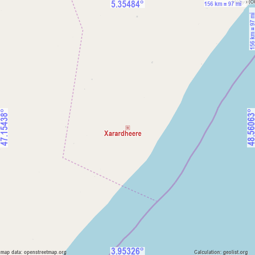
Xarardheere GPS coordinates[2]
4° 39' 15.84" North, 47° 51' 27" East
| Map corner | latitude | longitude |
|---|---|---|
| Upper-left | 5.35484°, | 47.15438° |
| Center: | 4.6544°, | 47.8575° |
| Lower-right: | 3.95326°, | 48.56063° |
| Map W x H: | 155.8×155.8 km | = 96.8×96.8mi |
| max Lat: | 11.96611° ⇑49.1% North |
| Xarardheere: | 4.6544° |
| min Lat: | ⇓50.9% South -1.21917° |
| min Long | Xarardheere | max Long |
| 41.83725° | 47.8575° | 51.0773° |
| W 79.2%⇐ | ⇒20.8% E |
Elevation
Elevation of Xarardheere is 226 m = 741 ft, and this is 63.9 m = 210 ft below average elevation for this country.
| Max E: |
1786 m = 5860 ft | 35.8% |
| Avg. | 289.9 m = 951 ft | |
| Xarardheere | 226 m = 741 ft | |
Min E: |
-2 m = -7 ft | 64.2% |
See also: Somalia elevation on elevation.city.
Geographical zone
Xarardheere is located in North Torrid zone (between Equator and Tropic of Cancer). Distance of Equator is 517.5 km =321.6 mi to South.| Distance of | km | miles | from Xarardheere |
|---|---|---|---|
| North Pole | 9489.5 | 5896.5 | to North |
| Arctic Circle | 6883.7 | 4277.3 | to North |
| Tropic Cancer | 2088.4 | 1297.7 | to North |
| Equator | 517.5 | 321.6 | to South |


Nearby cities:
15 places around Xarardheere: (largest is in red/bold)
• Adado
213.7 km =132.8 mi,  320°
320°
• Beledweyne
294.2 km =182.8 mi,  271°
271°
• Buulobarde
269.1 km =167.2 mi,  250°
250°
• Cadale
270.9 km =168.3 mi,  218°
218°
• Ceelbuur
137.4 km =85.4 mi, 271°
• Ceeldheer
116.9 km =72.6 mi, 219°
• Dhuusamarreeb
190.1 km =118.1 mi,  301°
301°
• Gaalkacyo
239.9 km =149.1 mi,  348°
348°
• Hobyo
107.2 km =66.6 mi,  43°
43°
• Jalalaqsi
287.9 km =178.9 mi,  240°
240°
• Jawhar
334.3 km =207.7 mi,  231°
231°
• Mahaddayweyne
318.4 km =197.8 mi, 234°
• Mogadishu
403.2 km =250.5 mi, 223°
• Tayeeglow
377.7 km =234.7 mi,  259°
259°
• Wanlaweyn
399.2 km =248.1 mi, 235°
Sources, notices
• [Note1] Compared only with cities in Somalia existing in our database
• [Src1] Map data: © OpenStreetMap contributors (CC-BY-SA)
• [Src2] Other city data from geonames.org with taken over terms of usage.
• [Src3] Geographical zone / Annual Mean Temperature by Robert A. Rohde @ Wikipedia
