Ceeldheer geodata
Ceeldheer (Galguduud) is a populated place; located in Somalia in Africa/Mogadishu (GMT+3) time zone. With population of 26,562 people, there are 21 cities with bigger population in this country. Compared to other cities in Somalia, 58.5% of cities are located further ↑North; 71.7% of cities are located further ←West and 71.7% of cities have higher elevation than Ceeldheer. Note1


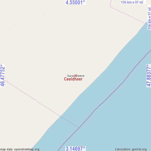
Ceeldheer GPS coordinates[2]
3° 50' 55.608" North, 47° 10' 50.304" East
| Map corner | latitude | longitude |
|---|---|---|
| Upper-left | 4.55001°, | 46.47752° |
| Center: | 3.84878°, | 47.18064° |
| Lower-right: | 3.14697°, | 47.88377° |
| Map W x H: | 156×156 km | = 96.9×96.9mi |
| max Lat: | 11.96611° ⇑58.5% North |
| Ceeldheer: | 3.84878° |
| min Lat: | ⇓41.5% South -1.21917° |
| min Long | Ceeldheer | max Long |
| 41.83725° | 47.18064° | 51.0773° |
| W 71.7%⇐ | ⇒28.3% E |
Elevation
Elevation of Ceeldheer is 20 m = 66 ft, and this is 269.9 m = 885 ft below average elevation for this country.
| Max E: |
1786 m = 5860 ft | 71.7% |
| Avg. | 289.9 m = 951 ft | |
| Ceeldheer | 20 m = 66 ft | |
Min E: |
-2 m = -7 ft | 28.3% |
See also: Somalia elevation on elevation.city.
Geographical zone
Ceeldheer is located in North Torrid zone (between Equator and Tropic of Cancer). Distance of Equator is 427.9 km =265.9 mi to South.| Distance of | km | miles | from Ceeldheer |
|---|---|---|---|
| North Pole | 9579.1 | 5952.2 | to North |
| Arctic Circle | 6973.2 | 4332.9 | to North |
| Tropic Cancer | 2178 | 1353.3 | to North |
| Equator | 427.9 | 265.9 | to South |


Nearby cities:
15 places around Ceeldheer: (largest is in red/bold)
• Adado
261.6 km =162.6 mi,  346°
346°
• Afgooye
297.4 km =184.8 mi,  230°
230°
• Beledweyne
240.4 km =149.4 mi,  294°
294°
• Buulobarde
179 km =111.2 mi,  270°
270°
• Cadale
154 km =95.7 mi,  218°
218°
• Ceelbuur
112 km =69.6 mi,  326°
326°
• Dhuusamarreeb
207.2 km =128.7 mi, 334°
• Hobyo
223.9 km =139.1 mi,  41°
41°
• Jalalaqsi
183.1 km =113.8 mi,  253°
253°
• Jawhar
221.1 km =137.4 mi,  237°
237°
• Mahaddayweyne
207 km =128.6 mi, 241°
• Mogadishu
286.7 km =178.1 mi, 225°
• Tayeeglow
296.7 km =184.4 mi, 273°
• Wanlaweyn
288.4 km =179.2 mi, 241°
• Xarardheere
116.9 km =72.6 mi, 39°
Sources, notices
• [Note1] Compared only with cities in Somalia existing in our database
• [Src1] Map data: © OpenStreetMap contributors (CC-BY-SA)
• [Src2] Other city data from geonames.org with taken over terms of usage.
• [Src3] Geographical zone / Annual Mean Temperature by Robert A. Rohde @ Wikipedia
