Shaydon geodata
Shaydon (Sughd) is a seat of a second-order administrative division; located in Tajikistan in Asia/Dushanbe (GMT+5) time zone. With population of 11,705 people, there are 30 cities with bigger population in this country. Compared to other cities in Tajikistan, 98.9% of cities are located further ↓South; 78.4% of cities are located further ←West and 53.4% of cities have lower elevation than Shaydon. Note1


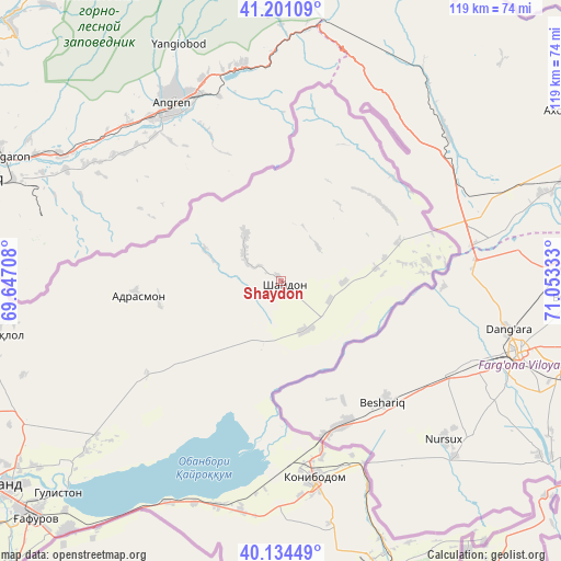
Shaydon GPS coordinates[2]
40° 40' 11.712" North, 70° 21' 0.72" East
| Map corner | latitude | longitude |
|---|---|---|
| Upper-left | 41.20109°, | 69.64708° |
| Center: | 40.66992°, | 70.3502° |
| Lower-right: | 40.13449°, | 71.05333° |
| Map W x H: | 118.6×118.6 km | = 73.7×73.7mi |
| max Lat: | 40.99827° ⇑1.1% North |
| Shaydon: | 40.66992° |
| min Lat: | ⇓98.9% South 36.72484° |
| min Long | Shaydon | max Long |
| 67.60931° | 70.3502° | 73.96674° |
| W 78.4%⇐ | ⇒21.6% E |
Elevation
Elevation of Shaydon is 838 m = 2749 ft, and this is 124.5 m = 408 ft below average elevation for this country.
| Max E: |
3607 m = 11834 ft | 46.6% |
| Avg. | 962.5 m = 3158 ft | |
| Shaydon | 838 m = 2749 ft | |
Min E: |
324 m = 1063 ft | 53.4% |
See also: Tajikistan elevation on elevation.city.
Geographical zone
Shaydon is located in North temperate zone (between Tropic of Cancer and the Arctic Circle). Distance of this Northern Tropic circle is 1916.2 km =1190.7 mi to South.| Distance of | km | miles | from Shaydon |
|---|---|---|---|
| North Pole | 5485 | 3408.2 | to North |
| Arctic Circle | 2879.1 | 1789 | to North |
| Tropic Cancer | 1916.2 | 1190.7 | to South |
| Equator | 4522.1 | 2809.9 | to South |


Nearby cities:
15 places around Shaydon: (largest is in red/bold)
• Adrasmon
30.9 km =19.2 mi,  265°
265°
• Chkalov
73.6 km =45.7 mi,  228°
228°
• Ghafurov
72.9 km =45.3 mi, 226°
• Isfara
64.8 km =40.3 mi,  158°
158°
• Khŭjand
75.1 km =46.7 mi,  235°
235°
• Kim
52.3 km =32.5 mi,  168°
168°
• Konibodom
42.3 km =26.3 mi, 170°
• Konsoy
58.2 km =36.2 mi,  250°
250°
• Navgarzan
37.1 km =23.1 mi,  10°
10°
• Neftobod
53.9 km =33.5 mi, 159°
• Oltintopkan
63.5 km =39.5 mi, 268°
• Palos
65 km =40.4 mi, 232°
• Quruqsoy
82.6 km =51.3 mi,  262°
262°
• Shŭrob
71.2 km =44.2 mi, 166°
• Taboshar
60.8 km =37.8 mi, 259°
Sources, notices
• [Note1] Compared only with cities in Tajikistan existing in our database
• [Src1] Map data: © OpenStreetMap contributors (CC-BY-SA)
• [Src2] Other city data from geonames.org with taken over terms of usage.
• [Src3] Geographical zone / Annual Mean Temperature by Robert A. Rohde @ Wikipedia
