Sinop geodata
Sinop is a seat of a first-order administrative division; located in Turkey in Europe/Istanbul (GMT+3) time zone. With population of 34,834 people, there are 228 cities with bigger population in this country. Compared to other cities in Turkey, 100% of cities are located further ↓South; 53.7% of cities are located further →East and 81.5% of cities have higher elevation than Sinop. Note1


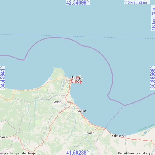
Sinop GPS coordinates[2]
42° 1' 36.588" North, 35° 9' 45.108" East
| Map corner | latitude | longitude |
|---|---|---|
| Upper-left | 42.54699°, | 34.45941° |
| Center: | 42.02683°, | 35.16253° |
| Lower-right: | 41.50238°, | 35.86566° |
| Map W x H: | 116.1×116.1 km | = 72.1×72.1mi |
| max Lat: | 42.02683° ⇑0% North |
| Sinop: | 42.02683° |
| min Lat: | ⇓100% South 35.9025° |
| min Long | Sinop | max Long |
| 25.90902° | 35.16253° | 44.60099° |
| W 46.3%⇐ | ⇒53.7% E |
Elevation
Elevation of Sinop is 100 m = 328 ft, and this is 617.4 m = 2026 ft below average elevation for this country.
| Max E: |
2682 m = 8799 ft | 81.5% |
| Avg. | 717.4 m = 2354 ft | |
| Sinop | 100 m = 328 ft | |
Min E: |
0 m = 0 ft | 18.5% |
See also: Turkey elevation on elevation.city.
Geographical zone
Sinop is located in North temperate zone (between Tropic of Cancer and the Arctic Circle). Distance of this Northern Tropic circle is 2067 km =1284.4 mi to South.| Distance of | km | miles | from Sinop |
|---|---|---|---|
| North Pole | 5334.1 | 3314.5 | to North |
| Arctic Circle | 2728.2 | 1695.2 | to North |
| Tropic Cancer | 2067 | 1284.4 | to South |
| Equator | 4672.9 | 2903.6 | to South |


Nearby cities:
15 places around Sinop: (largest is in red/bold)
• Alaçam
59.1 km =36.7 mi,  142°
142°
• Ayancık
48.5 km =30.1 mi,  259°
259°
• Boyabat
70.2 km =43.6 mi,  207°
207°
• Dikmen
42.8 km =26.6 mi,  168°
168°
• Durağan
68.5 km =42.6 mi,  187°
187°
• Erfelek
26 km =16.2 mi,  230°
230°
• Gerze
25 km =15.5 mi, 172°
• Güzelkent
64.1 km =39.8 mi, 262°
• Hanönü
72.8 km =45.2 mi, 232°
• Kabalı
21.1 km =13.1 mi,  203°
203°
• Türkeli
68.7 km =42.7 mi, 262°
• Yakakent
53.3 km =33.1 mi,  145°
145°
• Yenikonak
49.3 km =30.6 mi,  249°
249°
• Çatalzeytin
78.6 km =48.8 mi, 264°
• Çerçiler
70.6 km =43.9 mi, 174°
Sources, notices
• [Note1] Compared only with cities in Turkey existing in our database
• [Src1] Map data: © OpenStreetMap contributors (CC-BY-SA)
• [Src2] Other city data from geonames.org with taken over terms of usage.
• [Src3] Geographical zone / Annual Mean Temperature by Robert A. Rohde @ Wikipedia
