Saraydüzü geodata
Saraydüzü (Sinop) is a seat of a second-order administrative division; located in Turkey in Europe/Istanbul (GMT+3) time zone. In our database, there are 1323 cities with bigger population. Compared to other cities in Turkey, 95.9% of cities are located further ↓South; 54.8% of cities are located further →East and 64.7% of cities have higher elevation than Saraydüzü. Note1


Saraydüzü GPS coordinates[2]
41° 19' 43.14" North, 34° 50' 48.696" East
| Map corner | latitude | longitude |
|---|---|---|
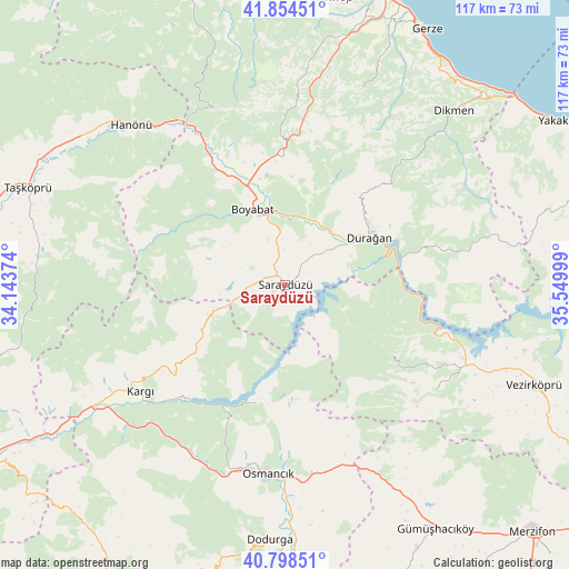
| Upper-left | 41.85451°, | 34.14374° |
| Center: | 41.32865°, | 34.84686° |
| Lower-right: | 40.79851°, | 35.54999° |
| Map W x H: | 117.4×117.4 km | = 72.9×72.9mi |
| max Lat: | 42.02683° ⇑4.1% North |
| Saraydüzü: | 41.32865° |
| min Lat: | ⇓95.9% South 35.9025° |
| min Long | Saraydüzü | max Long |
| 25.90902° | 34.84686° | 44.60099° |
| W 45.2%⇐ | ⇒54.8% E |
Elevation
Elevation of Saraydüzü is 424 m = 1391 ft, and this is 293.4 m = 963 ft below average elevation for this country.
| Max E: |
2682 m = 8799 ft | 64.7% |
| Avg. | 717.4 m = 2354 ft | |
| Saraydüzü | 424 m = 1391 ft | |
Min E: |
0 m = 0 ft | 35.3% |
See also: Turkey elevation on elevation.city.
Geographical zone
Saraydüzü is located in North temperate zone (between Tropic of Cancer and the Arctic Circle). Distance of this Northern Tropic circle is 1989.4 km =1236.2 mi to South.| Distance of | km | miles | from Saraydüzü |
|---|---|---|---|
| North Pole | 5411.7 | 3362.7 | to North |
| Arctic Circle | 2805.9 | 1743.5 | to North |
| Tropic Cancer | 1989.4 | 1236.2 | to South |
| Equator | 4595.3 | 2855.4 | to South |


Nearby cities:
15 places around Saraydüzü: (largest is in red/bold)
• Beşpınar
37.5 km =23.3 mi,  124°
124°
• Boyabat
17 km =10.6 mi,  336°
336°
• Dikmen
50 km =31.1 mi,  44°
44°
• Dodurga
52.8 km =32.8 mi,  183°
183°
• Durağan
19.8 km =12.3 mi,  60°
60°
• Hacıhamza
43.7 km =27.2 mi,  229°
229°
• Hanönü
45.9 km =28.5 mi,  316°
316°
• Kargı
37.1 km =23.1 mi, 234°
• Kâmil
26 km =16.2 mi,  195°
195°
• Mezraa
26.9 km =16.7 mi, 122°
• Osmancık
39.1 km =24.3 mi,  185°
185°
• Saraycık
47.6 km =29.6 mi,  152°
152°
• Taşköprü
56.5 km =35.1 mi,  290°
290°
• Vezirköprü
54.8 km =34.1 mi,  112°
112°
• Çerçiler
33.3 km =20.7 mi,  77°
77°
Sources, notices
• [Note1] Compared only with cities in Turkey existing in our database
• [Src1] Map data: © OpenStreetMap contributors (CC-BY-SA)
• [Src2] Other city data from geonames.org with taken over terms of usage.
• [Src3] Geographical zone / Annual Mean Temperature by Robert A. Rohde @ Wikipedia
