Sumbawanga geodata
Sumbawanga (Rukwa) is a seat of a first-order administrative division; located in Tanzania in Africa/Dar_es_Salaam (GMT+3) time zone. With population of 89,161 people, there are 19 cities with bigger population in this country. Compared to other cities in Tanzania, 74.5% of cities are located further ↑North; 90.2% of cities are located further →East and 97.6% of cities have lower elevation than Sumbawanga. Note1


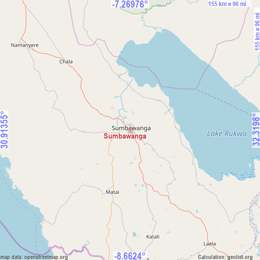
Sumbawanga GPS coordinates[2]
7° 58' 0.012" South, 31° 37' 0.012" East
| Map corner | latitude | longitude |
|---|---|---|
| Upper-left | -7.26976°, | 30.91355° |
| Center: | -7.96667°, | 31.61667° |
| Lower-right: | -8.6624°, | 32.3198° |
| Map W x H: | 154.8×154.9 km | = 96.2×96.3mi |
| max Lat: | -1.14389° ⇑74.5% North |
| Sumbawanga: | -7.96667° |
| min Lat: | ⇓25.5% South -11.36667° |
| min Long | Sumbawanga | max Long |
| 29.62667° | 31.61667° | 40.33333° |
| W 9.8%⇐ | ⇒90.2% E |
Elevation
Elevation of Sumbawanga is 1833 m = 6014 ft, and this is 890.2 m = 2921 ft above average elevation for this country.
| Max E: |
2377 m = 7799 ft | 2.4% |
| Sumbawanga | 1833 m 6014 ft | |
| Avg. | 942.8 m = 3093 ft | |
Min E: |
0 m = 0 ft | 97.6% |
See also: Sumbawanga elevation on elevation.city.
Geographical zone
Sumbawanga is located in South Torrid zone (between Equator and Tropic of Capricorn). Distance of Equator is 885.8 km =550.4 mi to North.| Distance of | km | miles | from Sumbawanga |
|---|---|---|---|
| Equator | 885.8 | 550.4 | to North |
| Tropic Capricorn | 1720.1 | 1068.8 | to South |
| Antarctic Circle | 6515.4 | 4048.5 | to South |
| South Pole | 9121.3 | 5667.7 | to South |


Nearby cities:
15 places around Sumbawanga: (largest is in red/bold)
• Chala
57.5 km =35.7 mi,  317°
317°
• Inyonga
147.6 km =91.7 mi,  19°
19°
• Itumba
234.6 km =145.8 mi,  132°
132°
• Karema
182 km =113.1 mi,  314°
314°
• Kirando
127.6 km =79.3 mi,  298°
298°
• Laela
82 km =51 mi,  144°
144°
• Matai
38.7 km =24 mi,  196°
196°
• Mbeya
226.8 km =140.9 mi,  117°
117°
• Mlowo
189.2 km =117.6 mi, 127°
• Mpanda
190.3 km =118.2 mi,  341°
341°
• Namanyere
80 km =49.7 mi, 308°
• Nkove
84.4 km =52.4 mi,  271°
271°
• Tunduma
194.8 km =121 mi, 139°
• Usevia
105.2 km =65.4 mi, 336°
• Vwawa
192.6 km =119.7 mi, 131°
Sources, notices
• [Note1] Compared only with cities in Tanzania existing in our database
• [Src1] Map data: © OpenStreetMap contributors (CC-BY-SA)
• [Src2] Other city data from geonames.org with taken over terms of usage.
• [Src3] Geographical zone / Annual Mean Temperature by Robert A. Rohde @ Wikipedia
