Nkove geodata
Nkove (Rukwa) is a populated place; located in Tanzania in Africa/Dar_es_Salaam (GMT+3) time zone. With population of 5,389 people, there are 271 cities with bigger population in this country. Compared to other cities in Tanzania, 73.8% of cities are located further ↑North; 95.8% of cities are located further →East and 63.3% of cities have higher elevation than Nkove. Note1


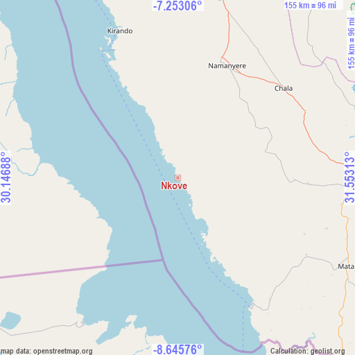
Nkove GPS coordinates[2]
7° 57' 0" South, 30° 51' 0" East
| Map corner | latitude | longitude |
|---|---|---|
| Upper-left | -7.25306°, | 30.14688° |
| Center: | -7.95°, | 30.85° |
| Lower-right: | -8.64576°, | 31.55313° |
| Map W x H: | 154.9×154.9 km | = 96.3×96.3mi |
| max Lat: | -1.14389° ⇑73.8% North |
| Nkove: | -7.95° |
| min Lat: | ⇓26.2% South -11.36667° |
| min Long | Nkove | max Long |
| 29.62667° | 30.85° | 40.33333° |
| W 4.2%⇐ | ⇒95.8% E |
Elevation
Elevation of Nkove is 813 m = 2667 ft, and this is 129.8 m = 426 ft below average elevation for this country.
| Max E: |
2377 m = 7799 ft | 63.3% |
| Avg. | 942.8 m = 3093 ft | |
| Nkove | 813 m = 2667 ft | |
Min E: |
0 m = 0 ft | 36.7% |
See also: Tanzania elevation on elevation.city.
Geographical zone
Nkove is located in South Torrid zone (between Equator and Tropic of Capricorn). Distance of Equator is 884 km =549.3 mi to North.| Distance of | km | miles | from Nkove |
|---|---|---|---|
| Equator | 884 | 549.3 | to North |
| Tropic Capricorn | 1722 | 1070 | to South |
| Antarctic Circle | 6517.2 | 4049.6 | to South |
| South Pole | 9123.1 | 5668.8 | to South |


Nearby cities:
15 places around Nkove: (largest is in red/bold)
• Chala
61.4 km =38.2 mi,  48°
48°
• Inyonga
191.9 km =119.2 mi,  44°
44°
• Itumba
302.9 km =188.2 mi,  122°
122°
• Karema
133.5 km =83 mi,  340°
340°
• Kirando
65.4 km =40.6 mi, 335°
• Laela
148.8 km =92.5 mi, 117°
• Matai
83.1 km =51.6 mi, 117°
• Mbeya
304.9 km =189.5 mi,  110°
110°
• Mlowo
262.1 km =162.9 mi, 116°
• Mpanda
180.2 km =112 mi,  7°
7°
• Namanyere
53 km =32.9 mi,  24°
24°
• Sumbawanga
84.4 km =52.4 mi,  91°
91°
• Tunduma
258.7 km =160.7 mi,  125°
125°
• Usevia
103.5 km =64.3 mi, 24°
• Vwawa
262.9 km =163.4 mi, 119°
Sources, notices
• [Note1] Compared only with cities in Tanzania existing in our database
• [Src1] Map data: © OpenStreetMap contributors (CC-BY-SA)
• [Src2] Other city data from geonames.org with taken over terms of usage.
• [Src3] Geographical zone / Annual Mean Temperature by Robert A. Rohde @ Wikipedia
