Sribne geodata
Sribne (Chernihiv) is a seat of a second-order administrative division; located in Ukraine in Europe/Kiev (GMT+3) time zone. With population of 3,534 people, there are 826 cities with bigger population in this country. Compared to other cities in Ukraine, 93.2% of cities are located further ↓South; 53% of cities are located further →East and 59.2% of cities have lower elevation than Sribne. Note1


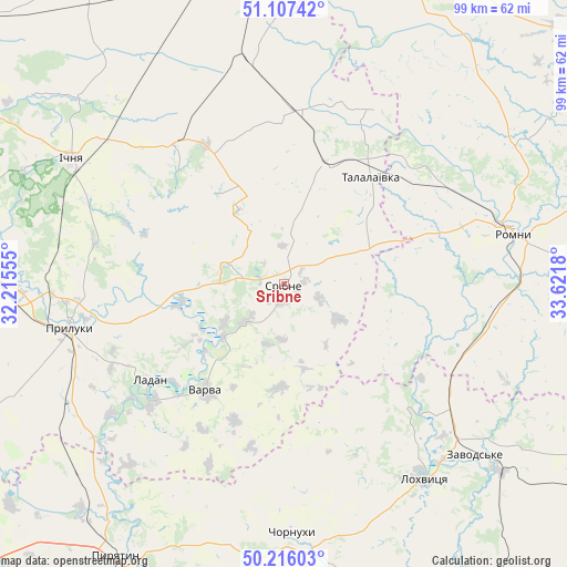
Sribne GPS coordinates[2]
50° 39' 49.824" North, 32° 55' 7.212" East
| Map corner | latitude | longitude |
|---|---|---|
| Upper-left | 51.10742°, | 32.21555° |
| Center: | 50.66384°, | 32.91867° |
| Lower-right: | 50.21603°, | 33.6218° |
| Map W x H: | 99.1×99.1 km | = 61.6×61.6mi |
| max Lat: | 52.18903° ⇑6.8% North |
| Sribne: | 50.66384° |
| min Lat: | ⇓93.2% South 44.39214° |
| min Long | Sribne | max Long |
| 22.20555° | 32.91867° | 40.13222° |
| W 47%⇐ | ⇒53% E |
Elevation
Elevation of Sribne is 166 m = 545 ft, and this is 10.2 m = 33 ft above average elevation for this country.
| Max E: |
886 m = 2907 ft | 40.8% |
| Sribne | 166 m 545 ft | |
| Avg. | 155.8 m = 511 ft | |
Min E: |
-3 m = -10 ft | 59.2% |
See also: Ukraine elevation on elevation.city.
Geographical zone
Sribne is located in North temperate zone (between Tropic of Cancer and the Arctic Circle). Distance of this North polar circle is 1767.9 km =1098.5 mi to North.| Distance of | km | miles | from Sribne |
|---|---|---|---|
| North Pole | 4373.8 | 2717.8 | to North |
| Arctic Circle | 1767.9 | 1098.5 | to North |
| Tropic Cancer | 3027.4 | 1881.1 | to South |
| Equator | 5633.3 | 3500.4 | to South |


Nearby cities:
15 places around Sribne: (largest is in red/bold)
• Bakhmach
57.9 km =36 mi,  354°
354°
• Chornukhy
44.1 km =27.4 mi,  177°
177°
• Dihtyari
13.8 km =8.6 mi,  229°
229°
• Druzhba
42.3 km =26.3 mi,  291°
291°
• Ichnya
43 km =26.7 mi,  300°
300°
• Ladan
28.7 km =17.8 mi,  236°
236°
• Lisovi Sorochyntsi
41.6 km =25.8 mi,  273°
273°
• Lokhvytsya
40.8 km =25.4 mi,  143°
143°
• Pryluky
38.3 km =23.8 mi,  258°
258°
• Pyryatyn
55.2 km =34.3 mi,  211°
211°
• Romny
40.3 km =25 mi,  76°
76°
• Sencha
54.6 km =33.9 mi,  146°
146°
• Talalayivka
25.1 km =15.6 mi,  39°
39°
• Varva
23.4 km =14.5 mi,  216°
216°
• Zhuravka
30.6 km =19 mi, 228°
Sources, notices
• [Note1] Compared only with cities in Ukraine existing in our database
• [Src1] Map data: © OpenStreetMap contributors (CC-BY-SA)
• [Src2] Other city data from geonames.org with taken over terms of usage.
• [Src3] Geographical zone / Annual Mean Temperature by Robert A. Rohde @ Wikipedia
