Sencha geodata
Sencha (Poltava) is a populated place; located in Ukraine in Europe/Kiev (GMT+3) time zone. With population of 2,953 people, there are 958 cities with bigger population in this country. Compared to other cities in Ukraine, 87.2% of cities are located further ↓South; 50.1% of cities are located further ←West and 58.5% of cities have higher elevation than Sencha. Note1


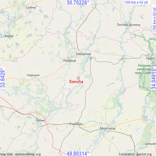
Sencha GPS coordinates[2]
50° 15' 17.352" North, 33° 20' 45.672" East
| Map corner | latitude | longitude |
|---|---|---|
| Upper-left | 50.70226°, | 32.6429° |
| Center: | 50.25482°, | 33.34602° |
| Lower-right: | 49.80314°, | 34.04915° |
| Map W x H: | 100×100 km | = 62.1×62.1mi |
| max Lat: | 52.18903° ⇑12.8% North |
| Sencha: | 50.25482° |
| min Lat: | ⇓87.2% South 44.39214° |
| min Long | Sencha | max Long |
| 22.20555° | 33.34602° | 40.13222° |
| W 50.1%⇐ | ⇒49.9% E |
Elevation
Elevation of Sencha is 111 m = 364 ft, and this is 44.8 m = 147 ft below average elevation for this country.
| Max E: |
886 m = 2907 ft | 58.5% |
| Avg. | 155.8 m = 511 ft | |
| Sencha | 111 m = 364 ft | |
Min E: |
-3 m = -10 ft | 41.5% |
See also: Ukraine elevation on elevation.city.
Geographical zone
Sencha is located in North temperate zone (between Tropic of Cancer and the Arctic Circle). Distance of this North polar circle is 1813.4 km =1126.8 mi to North.| Distance of | km | miles | from Sencha |
|---|---|---|---|
| North Pole | 4419.2 | 2746 | to North |
| Arctic Circle | 1813.4 | 1126.8 | to North |
| Tropic Cancer | 2981.9 | 1852.9 | to South |
| Equator | 5587.8 | 3472.1 | to South |


Nearby cities:
15 places around Sencha: (largest is in red/bold)
• Chornukhy
28.8 km =17.9 mi,  272°
272°
• Dihtyari
54.7 km =34 mi,  311°
311°
• Hadyach
47.6 km =29.6 mi,  74°
74°
• Khorol
52.6 km =32.7 mi,  185°
185°
• Komyshnya
25.2 km =15.7 mi,  108°
108°
• Lokhvytsya
14 km =8.7 mi,  334°
334°
• Lubny
36.4 km =22.6 mi,  223°
223°
• Lypova Dolyna
47 km =29.2 mi,  42°
42°
• Myrhorod
36.9 km =22.9 mi,  149°
149°
• Romny
55.9 km =34.7 mi,  9°
9°
• Romodan
29.4 km =18.3 mi,  182°
182°
• Sribne
54.6 km =33.9 mi, 326°
• Varva
51.8 km =32.2 mi,  301°
301°
• Velyka Bahachka
58.2 km =36.2 mi, 152°
• Velyki Sorochyntsi
49.6 km =30.8 mi,  121°
121°
Sources, notices
• [Note1] Compared only with cities in Ukraine existing in our database
• [Src1] Map data: © OpenStreetMap contributors (CC-BY-SA)
• [Src2] Other city data from geonames.org with taken over terms of usage.
• [Src3] Geographical zone / Annual Mean Temperature by Robert A. Rohde @ Wikipedia
