Hadyach geodata
Hadyach (Poltava) is a seat of a second-order administrative division; located in Ukraine in Europe/Kiev (GMT+3) time zone. With population of 22,667 people, there are 180 cities with bigger population in this country. Compared to other cities in Ukraine, 89.2% of cities are located further ↓South; 62.2% of cities are located further ←West and 55.5% of cities have lower elevation than Hadyach. Note1


Hadyach GPS coordinates[2]
50° 22' 16.032" North, 33° 59' 27.564" East
| Map corner | latitude | longitude |
|---|---|---|
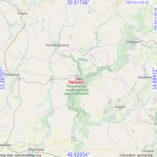
| Upper-left | 50.81746°, | 33.28787° |
| Center: | 50.37112°, | 33.99099° |
| Lower-right: | 49.92054°, | 34.69412° |
| Map W x H: | 99.7×99.7 km | = 62×62mi |
| max Lat: | 52.18903° ⇑10.8% North |
| Hadyach: | 50.37112° |
| min Lat: | ⇓89.2% South 44.39214° |
| min Long | Hadyach | max Long |
| 22.20555° | 33.99099° | 40.13222° |
| W 62.2%⇐ | ⇒37.8% E |
Elevation
Elevation of Hadyach is 154 m = 505 ft, and this is 1.8 m = 6 ft below average elevation for this country.
| Max E: |
886 m = 2907 ft | 44.5% |
| Avg. | 155.8 m = 511 ft | |
| Hadyach | 154 m = 505 ft | |
Min E: |
-3 m = -10 ft | 55.5% |
See also: Ukraine elevation on elevation.city.
Geographical zone
Hadyach is located in North temperate zone (between Tropic of Cancer and the Arctic Circle). Distance of this North polar circle is 1800.4 km =1118.7 mi to North.| Distance of | km | miles | from Hadyach |
|---|---|---|---|
| North Pole | 4406.3 | 2737.9 | to North |
| Arctic Circle | 1800.4 | 1118.7 | to North |
| Tropic Cancer | 2994.8 | 1860.9 | to South |
| Equator | 5600.7 | 3480.1 | to South |


Nearby cities:
15 places around Hadyach: (largest is in red/bold)
• Komyshnya
30.2 km =18.8 mi,  226°
226°
• Kotel’va
64.1 km =39.8 mi,  121°
121°
• Lebedyn
42.3 km =26.3 mi,  55°
55°
• Lokhvytsya
51.8 km =32.2 mi,  269°
269°
• Lypova Dolyna
25.5 km =15.8 mi,  327°
327°
• Myrhorod
52.4 km =32.6 mi,  211°
211°
• Nedryhayliv
52.1 km =32.4 mi,  351°
351°
• Okhtyrka
64.8 km =40.3 mi,  95°
95°
• Oposhnya
63.9 km =39.7 mi,  136°
136°
• Romny
55.8 km =34.7 mi,  319°
319°
• Romodan
63.6 km =39.5 mi, 228°
• Sencha
47.6 km =29.6 mi,  254°
254°
• Shyshaky
54.4 km =33.8 mi,  178°
178°
• Velyki Sorochyntsi
38.9 km =24.2 mi,  185°
185°
• Zin’kiv
32.1 km =19.9 mi, 124°
Sources, notices
• [Note1] Compared only with cities in Ukraine existing in our database
• [Src1] Map data: © OpenStreetMap contributors (CC-BY-SA)
• [Src2] Other city data from geonames.org with taken over terms of usage.
• [Src3] Geographical zone / Annual Mean Temperature by Robert A. Rohde @ Wikipedia
