Lypova Dolyna geodata
Lypova Dolyna (Sumy) is a seat of a second-order administrative division; located in Ukraine in Europe/Kiev (GMT+3) time zone. With population of 5,199 people, there are 633 cities with bigger population in this country. Compared to other cities in Ukraine, 91.6% of cities are located further ↓South; 57.8% of cities are located further ←West and 54.9% of cities have higher elevation than Lypova Dolyna. Note1


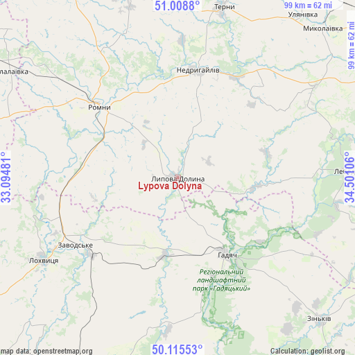
Lypova Dolyna GPS coordinates[2]
50° 33' 51.408" North, 33° 47' 52.548" East
| Map corner | latitude | longitude |
|---|---|---|
| Upper-left | 51.0088°, | 33.09481° |
| Center: | 50.56428°, | 33.79793° |
| Lower-right: | 50.11553°, | 34.50106° |
| Map W x H: | 99.3×99.3 km | = 61.7×61.7mi |
| max Lat: | 52.18903° ⇑8.4% North |
| Lypova Dolyna: | 50.56428° |
| min Lat: | ⇓91.6% South 44.39214° |
| min Long | Lypova Dolyna | max Long |
| 22.20555° | 33.79793° | 40.13222° |
| W 57.8%⇐ | ⇒42.2% E |
Elevation
Elevation of Lypova Dolyna is 120 m = 394 ft, and this is 35.8 m = 117 ft below average elevation for this country.
| Max E: |
886 m = 2907 ft | 54.9% |
| Avg. | 155.8 m = 511 ft | |
| Lypova Dolyna | 120 m = 394 ft | |
Min E: |
-3 m = -10 ft | 45.1% |
See also: Ukraine elevation on elevation.city.
Geographical zone
Lypova Dolyna is located in North temperate zone (between Tropic of Cancer and the Arctic Circle). Distance of this North polar circle is 1779 km =1105.4 mi to North.| Distance of | km | miles | from Lypova Dolyna |
|---|---|---|---|
| North Pole | 4384.8 | 2724.6 | to North |
| Arctic Circle | 1779 | 1105.4 | to North |
| Tropic Cancer | 3016.3 | 1874.2 | to South |
| Equator | 5622.2 | 3493.5 | to South |


Nearby cities:
15 places around Lypova Dolyna: (largest is in red/bold)
• Buryn’
70.6 km =43.9 mi,  2°
2°
• Chornukhy
69.1 km =42.9 mi,  241°
241°
• Hadyach
25.5 km =15.8 mi,  147°
147°
• Komyshnya
43.1 km =26.8 mi,  190°
190°
• Lebedyn
48.6 km =30.2 mi,  87°
87°
• Lokhvytsya
43.9 km =27.3 mi, 240°
• Myrhorod
67.6 km =42 mi, 191°
• Nedryhayliv
30.5 km =19 mi,  10°
10°
• Romny
30.8 km =19.1 mi,  312°
312°
• Sencha
47 km =29.2 mi,  222°
222°
• Sribne
63 km =39.1 mi,  280°
280°
• Talalayivka
55.3 km =34.4 mi,  303°
303°
• Terny
48.8 km =30.3 mi, 14°
• Velyki Sorochyntsi
61 km =37.9 mi,  170°
170°
• Zin’kiv
56.4 km =35 mi,  134°
134°
Sources, notices
• [Note1] Compared only with cities in Ukraine existing in our database
• [Src1] Map data: © OpenStreetMap contributors (CC-BY-SA)
• [Src2] Other city data from geonames.org with taken over terms of usage.
• [Src3] Geographical zone / Annual Mean Temperature by Robert A. Rohde @ Wikipedia
