Rocha geodata
Rocha is a seat of a first-order administrative division; located in Uruguay in America/Montevideo (GMT-3) time zone. With population of 25,515 people, there are 16 cities with bigger population in this country. Compared to other cities in Uruguay, 68.9% of cities are located further ↑North; 90.2% of cities are located further ←West and 70.5% of cities have higher elevation than Rocha. Note1


Rocha GPS coordinates[2]
34° 28' 59.988" South, 54° 19' 59.988" West
| Map corner | latitude | longitude |
|---|---|---|
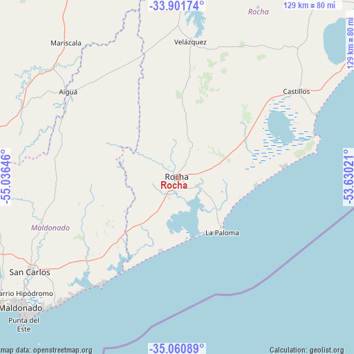
| Upper-left | -33.90174°, | -55.03646° |
| Center: | -34.48333°, | -54.33333° |
| Lower-right: | -35.06089°, | -53.63021° |
| Map W x H: | 128.9×128.9 km | = 80.1×80.1mi |
| max Lat: | -30.25966° ⇑68.9% North |
| Rocha: | -34.48333° |
| min Lat: | ⇓31.1% South -34.94747° |
| min Long | Rocha | max Long |
| -58.41176° | -54.33333° | -53.38583° |
| W 90.2%⇐ | ⇒9.8% E |
Elevation
Elevation of Rocha is 30 m = 98 ft, and this is 40.6 m = 133 ft below average elevation for this country.
| Max E: |
294 m = 965 ft | 70.5% |
| Avg. | 70.6 m = 232 ft | |
| Rocha | 30 m = 98 ft | |
Min E: |
2 m = 7 ft | 29.5% |
See also: Uruguay elevation on elevation.city.
Geographical zone
Rocha is located in South temperate zone (between Tropic of Capricorn and the Antarctic Circle). Distance of this Southern Tropic circle is 1228.3 km =763.2 mi to North.| Distance of | km | miles | from Rocha |
|---|---|---|---|
| Equator | 3834.2 | 2382.5 | to North |
| Tropic Capricorn | 1228.3 | 763.2 | to North |
| Antarctic Circle | 3567 | 2216.4 | to South |
| South Pole | 6172.9 | 3835.7 | to South |


Nearby cities:
15 places around Rocha: (largest is in red/bold)
• Aiguá
49.7 km =30.9 mi,  308°
308°
• Castillos
53.8 km =33.4 mi,  53°
53°
• Dieciocho de Julio
114.4 km =71.1 mi,  38°
38°
• La Paloma
25.2 km =15.7 mi,  142°
142°
• Lascano
90.9 km =56.5 mi,  7°
7°
• Maldonado
73 km =45.4 mi,  230°
230°
• Mariscala
63.9 km =39.7 mi,  320°
320°
• Minas
83.8 km =52.1 mi,  278°
278°
• Montes
112.6 km =70 mi,  269°
269°
• Pan de Azúcar
88.9 km =55.2 mi,  248°
248°
• Piriápolis
95.9 km =59.6 mi,  243°
243°
• Punta del Este
75.3 km =46.8 mi, 226°
• San Carlos
63.5 km =39.5 mi, 237°
• Solís de Mataojo
104.7 km =65.1 mi,  262°
262°
• Velázquez
49.9 km =31 mi, 5°
Sources, notices
• [Note1] Compared only with cities in Uruguay existing in our database
• [Src1] Map data: © OpenStreetMap contributors (CC-BY-SA)
• [Src2] Other city data from geonames.org with taken over terms of usage.
• [Src3] Geographical zone / Annual Mean Temperature by Robert A. Rohde @ Wikipedia
