Mutale geodata
Mutale (Limpopo) is a seat of a third-order administrative division; located in South Africa in Africa/Johannesburg (GMT+2) time zone. In our database, there are 257 cities with bigger population. Compared to other cities in South Africa, 99.7% of cities are located further ↓South; 91.2% of cities are located further ←West and 78.8% of cities have higher elevation than Mutale. Note1


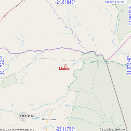
Mutale GPS coordinates[2]
22° 28' 10.992" South, 30° 52' 31.188" East
| Map corner | latitude | longitude |
|---|---|---|
| Upper-left | -21.81846°, | 30.17221° |
| Center: | -22.46972°, | 30.87533° |
| Lower-right: | -23.11793°, | 31.57846° |
| Map W x H: | 144.5×144.5 km | = 89.8×89.8mi |
| max Lat: | -22.34881° ⇑0.3% North |
| Mutale: | -22.46972° |
| min Lat: | ⇓99.7% South -34.66739° |
| min Long | Mutale | max Long |
| 16.8697° | 30.87533° | 32.26762° |
| W 91.2%⇐ | ⇒8.8% E |
Elevation
Elevation of Mutale is 337 m = 1106 ft, and this is 632.6 m = 2075 ft below average elevation for this country.
| Max E: |
1873 m = 6145 ft | 78.8% |
| Avg. | 969.6 m = 3181 ft | |
| Mutale | 337 m = 1106 ft | |
Min E: |
7 m = 23 ft | 21.2% |
See also: South Africa elevation on elevation.city.
Geographical zone
Mutale is located in South Torrid zone (between Equator and Tropic of Capricorn). Distance of this Southern Tropic circle is 107.5 km =66.8 mi to South.| Distance of | km | miles | from Mutale |
|---|---|---|---|
| Equator | 2498.4 | 1552.4 | to North |
| Tropic Capricorn | 107.5 | 66.8 | to South |
| Antarctic Circle | 4902.8 | 3046.5 | to South |
| South Pole | 7508.7 | 4665.7 | to South |


Nearby cities:
15 places around Mutale: (largest is in red/bold)
• Bochum
199.6 km =124 mi,  242°
242°
• Dendron
187.6 km =116.6 mi, 237°
• Duiwelskloof
155.5 km =96.6 mi,  208°
208°
• Ga-Kgapane
146.6 km =91.1 mi, 207°
• Giyani
94 km =58.4 mi,  189°
189°
• Hoedspruit
209.4 km =130.1 mi,  177°
177°
• Lebowakgomo
238.2 km =148 mi,  216°
216°
• Louis Trichardt
118.4 km =73.6 mi, 237°
• Mankoeng
192.4 km =119.6 mi, 214°
• Musina
86.8 km =53.9 mi,  278°
278°
• Nkowakowa
168.8 km =104.9 mi,  200°
200°
• Phalaborwa
166 km =103.1 mi,  170°
170°
• Polokwane
214.7 km =133.4 mi, 222°
• Thohoyandou
66.4 km =41.3 mi, 217°
• Tzaneen
168.2 km =104.5 mi, 205°
Sources, notices
• [Note1] Compared only with cities in South Africa existing in our database
• [Src1] Map data: © OpenStreetMap contributors (CC-BY-SA)
• [Src2] Other city data from geonames.org with taken over terms of usage.
• [Src3] Geographical zone / Annual Mean Temperature by Robert A. Rohde @ Wikipedia
