Kakamas geodata
Kakamas (Northern Cape) is a seat of a third-order administrative division; located in South Africa in Africa/Johannesburg (GMT+2) time zone. In our database, there are 257 cities with bigger population. Compared to other cities in South Africa, 53.1% of cities are located further ↑North; 88.5% of cities are located further →East and 70.2% of cities have higher elevation than Kakamas. Note1
Administrative division(s):
- Level 1: Northern Cape
- Level 2: Siyanda District Municipality
- Level 3: Kai !Garib


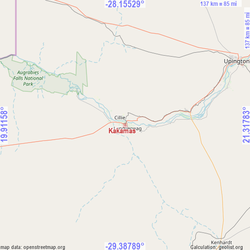
Kakamas GPS coordinates[2]
28° 46' 24.276" South, 20° 36' 52.92" East
| Map corner | latitude | longitude |
|---|---|---|
| Upper-left | -28.15529°, | 19.91158° |
| Center: | -28.77341°, | 20.6147° |
| Lower-right: | -29.38789°, | 21.31783° |
| Map W x H: | 137.1×137.1 km | = 85.2×85.2mi |
| max Lat: | -22.34881° ⇑53.1% North |
| Kakamas: | -28.77341° |
| min Lat: | ⇓46.9% South -34.66739° |
| min Long | Kakamas | max Long |
| 16.8697° | 20.6147° | 32.26762° |
| W 11.5%⇐ | ⇒88.5% E |
Elevation
Elevation of Kakamas is 664 m = 2178 ft, and this is 305.6 m = 1003 ft below average elevation for this country.
| Max E: |
1873 m = 6145 ft | 70.2% |
| Avg. | 969.6 m = 3181 ft | |
| Kakamas | 664 m = 2178 ft | |
Min E: |
7 m = 23 ft | 29.8% |
See also: South Africa elevation on elevation.city.
Geographical zone
Kakamas is located in South temperate zone (between Tropic of Capricorn and the Antarctic Circle). Distance of this Southern Tropic circle is 593.4 km =368.7 mi to North.| Distance of | km | miles | from Kakamas |
|---|---|---|---|
| Equator | 3199.3 | 1988 | to North |
| Tropic Capricorn | 593.4 | 368.7 | to North |
| Antarctic Circle | 4201.9 | 2610.9 | to South |
| South Pole | 6807.8 | 4230.2 | to South |


Nearby cities:
15 places around Kakamas: (largest is in red/bold)
• Brandvlei
188.5 km =117.1 mi,  183°
183°
• Calvinia
310.6 km =193 mi,  195°
195°
• Carnarvon
284.6 km =176.8 mi,  149°
149°
• Daniëlskuil
293.1 km =182.1 mi,  77°
77°
• Douglas
309.1 km =192.1 mi,  95°
95°
• Groblershoop
134 km =83.3 mi, 95°
• Kathu
266.9 km =165.8 mi,  63°
63°
• Kenhardt
82.7 km =51.4 mi,  140°
140°
• Pofadder
125.1 km =77.7 mi,  251°
251°
• Postmasburg
244.3 km =151.8 mi, 78°
• Prieska
229.2 km =142.4 mi,  115°
115°
• Springbok
282.7 km =175.7 mi, 249°
• Upington
72.3 km =44.9 mi, 59°
• Van Wyksvlei
210.9 km =131 mi, 146°
• Williston
286.9 km =178.3 mi,  174°
174°
Sources, notices
• [Note1] Compared only with cities in South Africa existing in our database
• [Src1] Map data: © OpenStreetMap contributors (CC-BY-SA)
• [Src2] Other city data from geonames.org with taken over terms of usage.
• [Src3] Geographical zone / Annual Mean Temperature by Robert A. Rohde @ Wikipedia
