Lupane geodata
Lupane (Matabeleland North) is a seat of a first-order administrative division; located in Zimbabwe in Africa/Harare (GMT+2) time zone. With population of 1,200 people, there are 64 cities with bigger population in this country. Compared to other cities in Zimbabwe, 63.1% of cities are located further ↑North; 92.3% of cities are located further →East and 78.5% of cities have higher elevation than Lupane. Note1


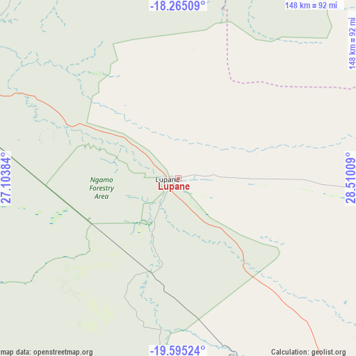
Lupane GPS coordinates[2]
18° 55' 53.364" South, 27° 48' 25.056" East
| Map corner | latitude | longitude |
|---|---|---|
| Upper-left | -18.26509°, | 27.10384° |
| Center: | -18.93149°, | 27.80696° |
| Lower-right: | -19.59524°, | 28.51009° |
| Map W x H: | 147.9×147.9 km | = 91.9×91.9mi |
| max Lat: | -16.03333° ⇑63.1% North |
| Lupane: | -18.93149° |
| min Lat: | ⇓36.9% South -22.21667° |
| min Long | Lupane | max Long |
| 25.83066° | 27.80696° | 32.86667° |
| W 7.7%⇐ | ⇒92.3% E |
Elevation
Elevation of Lupane is 1016 m = 3333 ft, and this is 181.7 m = 596 ft below average elevation for this country.
| Max E: |
1706 m = 5597 ft | 78.5% |
| Avg. | 1197.7 m = 3929 ft | |
| Lupane | 1016 m = 3333 ft | |
Min E: |
402 m = 1319 ft | 21.5% |
See also: Zimbabwe elevation on elevation.city.
Geographical zone
Lupane is located in South Torrid zone (between Equator and Tropic of Capricorn). Distance of this Southern Tropic circle is 500.9 km =311.2 mi to South.| Distance of | km | miles | from Lupane |
|---|---|---|---|
| Equator | 2105 | 1308 | to North |
| Tropic Capricorn | 500.9 | 311.2 | to South |
| Antarctic Circle | 5296.2 | 3290.9 | to South |
| South Pole | 7902.1 | 4910.1 | to South |


Nearby cities:
15 places around Lupane: (largest is in red/bold)
• Binga
153.9 km =95.6 mi,  341°
341°
• Bulawayo
158 km =98.2 mi,  149°
149°
• Dete
105 km =65.2 mi,  289°
289°
• Esigodini
191 km =118.7 mi,  142°
142°
• Gokwe
143.7 km =89.3 mi,  55°
55°
• Gweru
218.8 km =136 mi,  105°
105°
• Hwange
151.6 km =94.2 mi, 294°
• Insiza
174.1 km =108.2 mi,  122°
122°
• Inyati
136.9 km =85.1 mi,  127°
127°
• Kadoma
231.9 km =144.1 mi,  73°
73°
• Kamativi Mine
104.5 km =64.9 mi,  310°
310°
• Kwekwe
211.2 km =131.2 mi,  89°
89°
• Plumtree
172.6 km =107.2 mi,  179°
179°
• Redcliff
208.1 km =129.3 mi, 93°
• Shangani
189.1 km =117.5 mi, 120°
Sources, notices
• [Note1] Compared only with cities in Zimbabwe existing in our database
• [Src1] Map data: © OpenStreetMap contributors (CC-BY-SA)
• [Src2] Other city data from geonames.org with taken over terms of usage.
• [Src3] Geographical zone / Annual Mean Temperature by Robert A. Rohde @ Wikipedia
