Binga geodata
Binga (Matabeleland North) is a populated place; located in Zimbabwe in Africa/Harare (GMT+2) time zone. With population of 4,327 people, there are 45 cities with bigger population in this country. Compared to other cities in Zimbabwe, 73.8% of cities are located further ↓South; 93.8% of cities are located further →East and 95.4% of cities have higher elevation than Binga. Note1


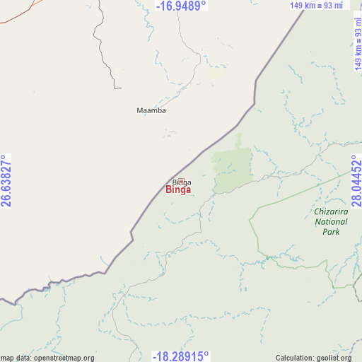
Binga GPS coordinates[2]
17° 37' 12.972" South, 27° 20' 29.004" East
| Map corner | latitude | longitude |
|---|---|---|
| Upper-left | -16.9489°, | 26.63827° |
| Center: | -17.62027°, | 27.34139° |
| Lower-right: | -18.28915°, | 28.04452° |
| Map W x H: | 149×149 km | = 92.6×92.6mi |
| max Lat: | -16.03333° ⇑26.2% North |
| Binga: | -17.62027° |
| min Lat: | ⇓73.8% South -22.21667° |
| min Long | Binga | max Long |
| 25.83066° | 27.34139° | 32.86667° |
| W 6.2%⇐ | ⇒93.8% E |
Elevation
Elevation of Binga is 628 m = 2060 ft, and this is 569.7 m = 1869 ft below average elevation for this country.
| Max E: |
1706 m = 5597 ft | 95.4% |
| Avg. | 1197.7 m = 3929 ft | |
| Binga | 628 m = 2060 ft | |
Min E: |
402 m = 1319 ft | 4.6% |
See also: Zimbabwe elevation on elevation.city.
Geographical zone
Binga is located in South Torrid zone (between Equator and Tropic of Capricorn). Distance of this Southern Tropic circle is 646.7 km =401.8 mi to South.| Distance of | km | miles | from Binga |
|---|---|---|---|
| Equator | 1959.2 | 1217.4 | to North |
| Tropic Capricorn | 646.7 | 401.8 | to South |
| Antarctic Circle | 5442 | 3381.5 | to South |
| South Pole | 8047.9 | 5000.7 | to South |


Nearby cities:
15 places around Binga: (largest is in red/bold)
• Chakari
274.5 km =170.6 mi,  100°
100°
• Chegutu
301.6 km =187.4 mi, 100°
• Chirundu
238.6 km =148.3 mi,  42°
42°
• Dete
121.6 km =75.6 mi,  204°
204°
• Gokwe
180.7 km =112.3 mi,  111°
111°
• Hwange
121.6 km =75.6 mi,  227°
227°
• Inyati
278.2 km =172.9 mi,  145°
145°
• Kadoma
283.5 km =176.2 mi, 106°
• Kamativi Mine
83 km =51.6 mi, 201°
• Kariba
197.7 km =122.8 mi,  51°
51°
• Karoi
265.5 km =165 mi,  70°
70°
• Kwekwe
298.9 km =185.7 mi,  119°
119°
• Lupane
153.9 km =95.6 mi,  161°
161°
• Redcliff
301.9 km =187.6 mi, 121°
• Victoria Falls
163.7 km =101.7 mi,  257°
257°
Sources, notices
• [Note1] Compared only with cities in Zimbabwe existing in our database
• [Src1] Map data: © OpenStreetMap contributors (CC-BY-SA)
• [Src2] Other city data from geonames.org with taken over terms of usage.
• [Src3] Geographical zone / Annual Mean Temperature by Robert A. Rohde @ Wikipedia
