Kamativi Mine geodata
Kamativi Mine (Matabeleland North) is a populated place; located in Zimbabwe in Africa/Harare (GMT+2) time zone. With population of 1,575 people, there are 62 cities with bigger population in this country. Compared to other cities in Zimbabwe, 50.8% of cities are located further ↑North; 95.4% of cities are located further →East and 87.7% of cities have higher elevation than Kamativi Mine. Note1


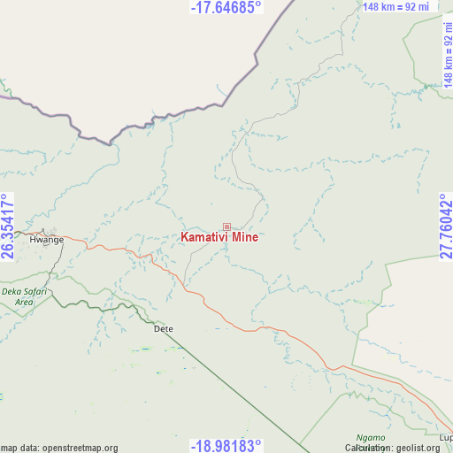
Kamativi Mine GPS coordinates[2]
18° 18' 56.268" South, 27° 3' 26.244" East
| Map corner | latitude | longitude |
|---|---|---|
| Upper-left | -17.64685°, | 26.35417° |
| Center: | -18.31563°, | 27.05729° |
| Lower-right: | -18.98183°, | 27.76042° |
| Map W x H: | 148.4×148.4 km | = 92.2×92.2mi |
| max Lat: | -16.03333° ⇑50.8% North |
| Kamativi Mine: | -18.31563° |
| min Lat: | ⇓49.2% South -22.21667° |
| min Long | Kamativi Mine | max Long |
| 25.83066° | 27.05729° | 32.86667° |
| W 4.6%⇐ | ⇒95.4% E |
Elevation
Elevation of Kamativi Mine is 953 m = 3127 ft, and this is 244.7 m = 803 ft below average elevation for this country.
| Max E: |
1706 m = 5597 ft | 87.7% |
| Avg. | 1197.7 m = 3929 ft | |
| Kamativi Mine | 953 m = 3127 ft | |
Min E: |
402 m = 1319 ft | 12.3% |
See also: Zimbabwe elevation on elevation.city.
Geographical zone
Kamativi Mine is located in South Torrid zone (between Equator and Tropic of Capricorn). Distance of this Southern Tropic circle is 569.4 km =353.8 mi to South.| Distance of | km | miles | from Kamativi Mine |
|---|---|---|---|
| Equator | 2036.5 | 1265.4 | to North |
| Tropic Capricorn | 569.4 | 353.8 | to South |
| Antarctic Circle | 5364.7 | 3333.5 | to South |
| South Pole | 7970.6 | 4952.7 | to South |


Nearby cities:
15 places around Kamativi Mine: (largest is in red/bold)
• Binga
83 km =51.6 mi,  21°
21°
• Bulawayo
259.4 km =161.2 mi,  141°
141°
• Dete
39 km =24.2 mi,  210°
210°
• Esigodini
294.1 km =182.7 mi, 138°
• Gokwe
198.6 km =123.4 mi,  86°
86°
• Hwange
59.2 km =36.8 mi,  264°
264°
• Insiza
278.1 km =172.8 mi,  125°
125°
• Inyati
241.4 km =150 mi, 128°
• Kariba
272.4 km =169.3 mi,  42°
42°
• Kwekwe
298.4 km =185.4 mi,  103°
103°
• Lupane
104.5 km =64.9 mi, 130°
• Plumtree
253.8 km =157.7 mi,  161°
161°
• Redcliff
298 km =185.2 mi,  105°
105°
• Shangani
292.5 km =181.8 mi,  123°
123°
• Victoria Falls
136.4 km =84.8 mi,  288°
288°
Sources, notices
• [Note1] Compared only with cities in Zimbabwe existing in our database
• [Src1] Map data: © OpenStreetMap contributors (CC-BY-SA)
• [Src2] Other city data from geonames.org with taken over terms of usage.
• [Src3] Geographical zone / Annual Mean Temperature by Robert A. Rohde @ Wikipedia
