Concession geodata
Concession (Mashonaland Central) is a populated place; located in Zimbabwe in Africa/Harare (GMT+2) time zone. With population of 4,983 people, there are 42 cities with bigger population in this country. Compared to other cities in Zimbabwe, 78.5% of cities are located further ↓South; 60% of cities are located further ←West and 63.1% of cities have lower elevation than Concession. Note1


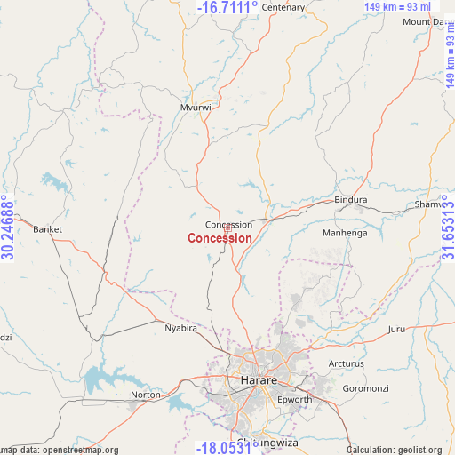
Concession GPS coordinates[2]
17° 22' 59.988" South, 30° 57' 0" East
| Map corner | latitude | longitude |
|---|---|---|
| Upper-left | -16.7111°, | 30.24688° |
| Center: | -17.38333°, | 30.95° |
| Lower-right: | -18.0531°, | 31.65313° |
| Map W x H: | 149.2×149.2 km | = 92.7×92.7mi |
| max Lat: | -16.03333° ⇑21.5% North |
| Concession: | -17.38333° |
| min Lat: | ⇓78.5% South -22.21667° |
| min Long | Concession | max Long |
| 25.83066° | 30.95° | 32.86667° |
| W 60%⇐ | ⇒40% E |
Elevation
Elevation of Concession is 1331 m = 4367 ft, and this is 133.3 m = 437 ft above average elevation for this country.
| Max E: |
1706 m = 5597 ft | 36.9% |
| Concession | 1331 m 4367 ft | |
| Avg. | 1197.7 m = 3929 ft | |
Min E: |
402 m = 1319 ft | 63.1% |
See also: Zimbabwe elevation on elevation.city.
Geographical zone
Concession is located in South Torrid zone (between Equator and Tropic of Capricorn). Distance of this Southern Tropic circle is 673.1 km =418.2 mi to South.| Distance of | km | miles | from Concession |
|---|---|---|---|
| Equator | 1932.8 | 1201 | to North |
| Tropic Capricorn | 673.1 | 418.2 | to South |
| Antarctic Circle | 5468.3 | 3397.8 | to South |
| South Pole | 8074.2 | 5017.1 | to South |


Nearby cities:
15 places around Concession: (largest is in red/bold)
• Banket
58.4 km =36.3 mi,  270°
270°
• Bindura
41.4 km =25.7 mi,  77°
77°
• Centenary
75.5 km =46.9 mi,  13°
13°
• Chinhoyi
79.6 km =49.5 mi, 271°
• Chitungwiza
71.2 km =44.2 mi,  169°
169°
• Epworth
60.1 km =37.3 mi,  159°
159°
• Glendale
12.8 km =8 mi, 75°
• Harare
50.6 km =31.4 mi, 167°
• Madziwa
80.8 km =50.2 mi,  50°
50°
• Mazowe
13.7 km =8.5 mi, 169°
• Mvurwi
40.3 km =25 mi,  344°
344°
• Norton
61.6 km =38.3 mi,  205°
205°
• Raffingora
67.3 km =41.8 mi,  305°
305°
• Ruwa
64.4 km =40 mi,  150°
150°
• Shamva
66.9 km =41.6 mi, 83°
Sources, notices
• [Note1] Compared only with cities in Zimbabwe existing in our database
• [Src1] Map data: © OpenStreetMap contributors (CC-BY-SA)
• [Src2] Other city data from geonames.org with taken over terms of usage.
• [Src3] Geographical zone / Annual Mean Temperature by Robert A. Rohde @ Wikipedia
