Panjāb geodata
Panjāb (Bamyan) is a seat of a second-order administrative division; located in Afghanistan in Asia/Kabul (GMT+4.5) time zone. With population of 13,471 people, there are 52 cities with bigger population in this country. Compared to other cities in Afghanistan, 57.6% of cities are located further ↑North; 61.1% of cities are located further →East and 98.1% of cities have lower elevation than Panjāb. Note1


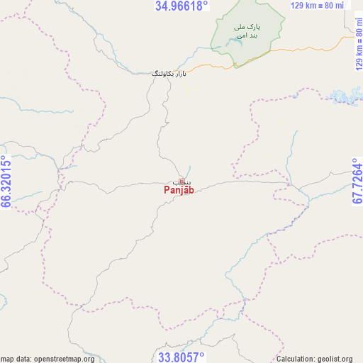
Panjāb GPS coordinates[2]
34° 23' 16.62" North, 67° 1' 23.772" East
| Map corner | latitude | longitude |
|---|---|---|
| Upper-left | 34.96618°, | 66.32015° |
| Center: | 34.38795°, | 67.02327° |
| Lower-right: | 33.8057°, | 67.7264° |
| Map W x H: | 129×129 km | = 80.2×80.2mi |
| max Lat: | 38.4435° ⇑57.6% North |
| Panjāb: | 34.38795° |
| min Lat: | ⇓42.4% South 30.15° |
| min Long | Panjāb | max Long |
| 61.06667° | 67.02327° | 72.318° |
| W 38.9%⇐ | ⇒61.1% E |
Elevation
Elevation of Panjāb is 2728 m = 8950 ft, and this is 1309.6 m = 4297 ft above average elevation for this country.
| Max E: |
3068 m = 10066 ft | 1.9% |
| Panjāb | 2728 m 8950 ft | |
| Avg. | 1418.4 m = 4654 ft | |
Min E: |
254 m = 833 ft | 98.1% |
See also: Afghanistan elevation on elevation.city.
Geographical zone
Panjāb is located in North temperate zone (between Tropic of Cancer and the Arctic Circle). Distance of this Northern Tropic circle is 1217.7 km =756.6 mi to South.| Distance of | km | miles | from Panjāb |
|---|---|---|---|
| North Pole | 6183.5 | 3842.2 | to North |
| Arctic Circle | 3577.6 | 2223 | to North |
| Tropic Cancer | 1217.7 | 756.6 | to South |
| Equator | 3823.6 | 2375.9 | to South |


Nearby cities:
15 places around Panjāb: (largest is in red/bold)
• Bulōlah
111.6 km =69.3 mi,  60°
60°
• Bāmyān
88 km =54.7 mi, 56°
• Chowṉêy
131.5 km =81.7 mi,  211°
211°
• Dowlatyār
114.2 km =71 mi,  279°
279°
• Khadīr
112.8 km =70.1 mi,  242°
242°
• Khudāydād Khēl
106.8 km =66.4 mi,  34°
34°
• Larkird
126.8 km =78.8 mi,  345°
345°
• La‘l
69.3 km =43.1 mi, 280°
• Mīrān
119.9 km =74.5 mi,  98°
98°
• Nayak
39 km =24.2 mi, 350°
• Nīlī
110.7 km =68.8 mi,  228°
228°
• Quchanghī
77.5 km =48.2 mi, 242°
• Rū-ye Sang
117.7 km =73.1 mi, 28°
• Wulêswālī Bihsūd
81.1 km =50.4 mi,  93°
93°
• Ōkak
101.7 km =63.2 mi,  122°
122°
Sources, notices
• [Note1] Compared only with cities in Afghanistan existing in our database
• [Src1] Map data: © OpenStreetMap contributors (CC-BY-SA)
• [Src2] Other city data from geonames.org with taken over terms of usage.
• [Src3] Geographical zone / Annual Mean Temperature by Robert A. Rohde @ Wikipedia
