Nayak geodata
Nayak (Bamyan) is a seat of a second-order administrative division; located in Afghanistan in Asia/Kabul (GMT+4.5) time zone. In our database, there are 93 cities with bigger population. Compared to other cities in Afghanistan, 51.1% of cities are located further ↓South; 61.7% of cities are located further →East and 95.8% of cities have lower elevation than Nayak. Note1


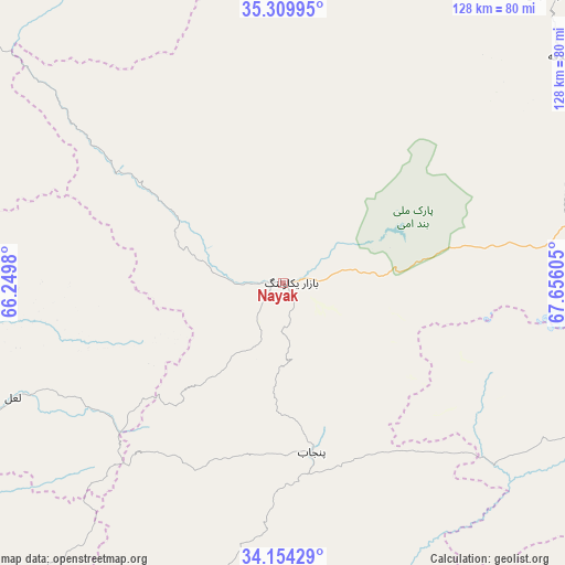
Nayak GPS coordinates[2]
34° 44' 2.904" North, 66° 57' 10.512" East
| Map corner | latitude | longitude |
|---|---|---|
| Upper-left | 35.30995°, | 66.2498° |
| Center: | 34.73414°, | 66.95292° |
| Lower-right: | 34.15429°, | 67.65605° |
| Map W x H: | 128.5×128.5 km | = 79.8×79.8mi |
| max Lat: | 38.4435° ⇑48.9% North |
| Nayak: | 34.73414° |
| min Lat: | ⇓51.1% South 30.15° |
| min Long | Nayak | max Long |
| 61.06667° | 66.95292° | 72.318° |
| W 38.3%⇐ | ⇒61.7% E |
Elevation
Elevation of Nayak is 2554 m = 8379 ft, and this is 1135.6 m = 3726 ft above average elevation for this country.
| Max E: |
3068 m = 10066 ft | 4.2% |
| Nayak | 2554 m 8379 ft | |
| Avg. | 1418.4 m = 4654 ft | |
Min E: |
254 m = 833 ft | 95.8% |
See also: Afghanistan elevation on elevation.city.
Geographical zone
Nayak is located in North temperate zone (between Tropic of Cancer and the Arctic Circle). Distance of this Northern Tropic circle is 1256.2 km =780.6 mi to South.| Distance of | km | miles | from Nayak |
|---|---|---|---|
| North Pole | 6145 | 3818.3 | to North |
| Arctic Circle | 3539.1 | 2199.1 | to North |
| Tropic Cancer | 1256.2 | 780.6 | to South |
| Equator | 3862.1 | 2399.8 | to South |


Nearby cities:
15 places around Nayak: (largest is in red/bold)
• Bulōlah
104.8 km =65.1 mi,  81°
81°
• Bāmyān
80.4 km =50 mi, 83°
• Chīras
116.5 km =72.4 mi,  310°
310°
• Dowlatyār
108 km =67.1 mi,  259°
259°
• Dūāb
121.4 km =75.4 mi,  40°
40°
• Khadīr
130 km =80.8 mi,  226°
226°
• Khudāydād Khēl
83.2 km =51.7 mi,  53°
53°
• Larkird
88 km =54.7 mi,  342°
342°
• La‘l
66.8 km =41.5 mi,  247°
247°
• Panjāb
39 km =24.2 mi,  170°
170°
• Quchanghī
97.1 km =60.3 mi,  219°
219°
• Rū-ye Sang
89.9 km =55.9 mi, 43°
• Sang-e Chārak
132.6 km =82.4 mi, 339°
• Wulêswālī Bihsūd
97.5 km =60.6 mi,  116°
116°
• Ōkak
130.9 km =81.3 mi,  135°
135°
Sources, notices
• [Note1] Compared only with cities in Afghanistan existing in our database
• [Src1] Map data: © OpenStreetMap contributors (CC-BY-SA)
• [Src2] Other city data from geonames.org with taken over terms of usage.
• [Src3] Geographical zone / Annual Mean Temperature by Robert A. Rohde @ Wikipedia
