Tagāw-Bāy geodata
Tagāw-Bāy (Sar-e Pol) is a populated place; located in Afghanistan in Asia/Kabul (GMT+4.5) time zone. With population of 9,096 people, there are 73 cities with bigger population in this country. Compared to other cities in Afghanistan, 72.3% of cities are located further ↓South; 71.1% of cities are located further →East and 60.8% of cities have lower elevation than Tagāw-Bāy. Note1


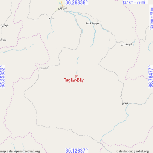
Tagāw-Bāy GPS coordinates[2]
35° 41' 57.876" North, 66° 3' 41.904" East
| Map corner | latitude | longitude |
|---|---|---|
| Upper-left | 36.26836°, | 65.35852° |
| Center: | 35.69941°, | 66.06164° |
| Lower-right: | 35.12637°, | 66.76477° |
| Map W x H: | 127×127 km | = 78.9×78.9mi |
| max Lat: | 38.4435° ⇑27.7% North |
| Tagāw-Bāy: | 35.69941° |
| min Lat: | ⇓72.3% South 30.15° |
| min Long | Tagāw-Bāy | max Long |
| 61.06667° | 66.06164° | 72.318° |
| W 28.9%⇐ | ⇒71.1% E |
Elevation
Elevation of Tagāw-Bāy is 1666 m = 5466 ft, and this is 247.6 m = 812 ft above average elevation for this country.
| Max E: |
3068 m = 10066 ft | 39.2% |
| Tagāw-Bāy | 1666 m 5466 ft | |
| Avg. | 1418.4 m = 4654 ft | |
Min E: |
254 m = 833 ft | 60.8% |
See also: Afghanistan elevation on elevation.city.
Geographical zone
Tagāw-Bāy is located in North temperate zone (between Tropic of Cancer and the Arctic Circle). Distance of this Northern Tropic circle is 1363.5 km =847.2 mi to South.| Distance of | km | miles | from Tagāw-Bāy |
|---|---|---|---|
| North Pole | 6037.7 | 3751.7 | to North |
| Arctic Circle | 3431.8 | 2132.4 | to North |
| Tropic Cancer | 1363.5 | 847.2 | to South |
| Equator | 3969.4 | 2466.5 | to South |


Nearby cities:
15 places around Tagāw-Bāy: (largest is in red/bold)
• Bal Chirāgh
76.6 km =47.6 mi,  281°
281°
• Chīras
32.2 km =20 mi,  192°
192°
• Darzāb
68.9 km =42.8 mi,  296°
296°
• Lab-Sar
78.8 km =49 mi,  62°
62°
• Larkird
59.3 km =36.8 mi,  113°
113°
• Pasnay
27.8 km =17.3 mi,  285°
285°
• Qal‘ah-ye Shahr
47.7 km =29.6 mi,  249°
249°
• Sang-e Chārak
37.8 km =23.5 mi, 63°
• Sar Chakān
75 km =46.6 mi,  270°
270°
• Sar-e Pul
58.5 km =36.4 mi,  348°
348°
• Shibirghān
111.2 km =69.1 mi, 345°
• Sōzmah Qal‘ah
46.4 km =28.8 mi,  16°
16°
• Tukzār
42.6 km =26.5 mi,  49°
49°
• Āq Kupruk
82.1 km =51 mi, 58°
• Şayād
52.8 km =32.8 mi,  336°
336°
Sources, notices
• [Note1] Compared only with cities in Afghanistan existing in our database
• [Src1] Map data: © OpenStreetMap contributors (CC-BY-SA)
• [Src2] Other city data from geonames.org with taken over terms of usage.
• [Src3] Geographical zone / Annual Mean Temperature by Robert A. Rohde @ Wikipedia
