Darzāb geodata
Darzāb (Jowzjan) is a seat of a second-order administrative division; located in Afghanistan in Asia/Kabul (GMT+4.5) time zone. With population of 9,642 people, there are 71 cities with bigger population in this country. Compared to other cities in Afghanistan, 76.2% of cities are located further ↓South; 77.8% of cities are located further →East and 59.2% of cities have higher elevation than Darzāb. Note1


Darzāb GPS coordinates[2]
35° 58' 38.784" North, 65° 22' 41.808" East
| Map corner | latitude | longitude |
|---|---|---|
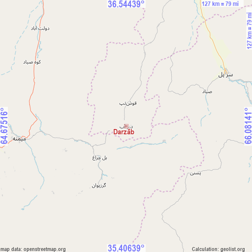
| Upper-left | 36.54439°, | 64.67516° |
| Center: | 35.97744°, | 65.37828° |
| Lower-right: | 35.40639°, | 66.08141° |
| Map W x H: | 126.5×126.5 km | = 78.6×78.6mi |
| max Lat: | 38.4435° ⇑23.8% North |
| Darzāb: | 35.97744° |
| min Lat: | ⇓76.2% South 30.15° |
| min Long | Darzāb | max Long |
| 61.06667° | 65.37828° | 72.318° |
| W 22.2%⇐ | ⇒77.8% E |
Elevation
Elevation of Darzāb is 1179 m = 3868 ft, and this is 239.4 m = 785 ft below average elevation for this country.
| Max E: |
3068 m = 10066 ft | 59.2% |
| Avg. | 1418.4 m = 4654 ft | |
| Darzāb | 1179 m = 3868 ft | |
Min E: |
254 m = 833 ft | 40.8% |
See also: Afghanistan elevation on elevation.city.
Geographical zone
Darzāb is located in North temperate zone (between Tropic of Cancer and the Arctic Circle). Distance of this Northern Tropic circle is 1394.4 km =866.4 mi to South.| Distance of | km | miles | from Darzāb |
|---|---|---|---|
| North Pole | 6006.7 | 3732.4 | to North |
| Arctic Circle | 3400.9 | 2113.2 | to North |
| Tropic Cancer | 1394.4 | 866.4 | to South |
| Equator | 4000.3 | 2485.7 | to South |


Nearby cities:
15 places around Darzāb: (largest is in red/bold)
• Bal Chirāgh
20.2 km =12.6 mi,  221°
221°
• Chīras
82.8 km =51.4 mi,  138°
138°
• Dowlatābād
65.2 km =40.5 mi,  320°
320°
• Fayẕābād
58 km =36 mi,  306°
306°
• Lāsh
86.1 km =53.5 mi, 219°
• Maymana
53.9 km =33.5 mi,  263°
263°
• Pasnay
42 km =26.1 mi,  123°
123°
• Qal‘ah-ye Shahr
50.8 km =31.6 mi,  160°
160°
• Sar Chakān
33.4 km =20.8 mi,  203°
203°
• Sar-e Pul
56.4 km =35 mi,  62°
62°
• Shibirghān
83.8 km =52.1 mi,  23°
23°
• Sōzmah Qal‘ah
75.8 km =47.1 mi,  79°
79°
• Tagāw-Bāy
68.9 km =42.8 mi, 116°
• Şayād
44.2 km =27.5 mi,  66°
66°
• ‘Alāqahdārī-ye Almār
77.7 km =48.3 mi, 259°
Sources, notices
• [Note1] Compared only with cities in Afghanistan existing in our database
• [Src1] Map data: © OpenStreetMap contributors (CC-BY-SA)
• [Src2] Other city data from geonames.org with taken over terms of usage.
• [Src3] Geographical zone / Annual Mean Temperature by Robert A. Rohde @ Wikipedia
