Tukzār geodata
Tukzār (Sar-e Pol) is a seat of a second-order administrative division; located in Afghanistan in Asia/Kabul (GMT+4.5) time zone. With population of 12,021 people, there are 62 cities with bigger population in this country. Compared to other cities in Afghanistan, 75.6% of cities are located further ↓South; 66.9% of cities are located further →East and 57.2% of cities have higher elevation than Tukzār. Note1


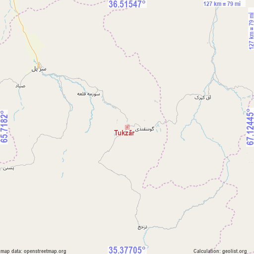
Tukzār GPS coordinates[2]
35° 56' 53.916" North, 66° 25' 16.752" East
| Map corner | latitude | longitude |
|---|---|---|
| Upper-left | 36.51547°, | 65.7182° |
| Center: | 35.94831°, | 66.42132° |
| Lower-right: | 35.37705°, | 67.12445° |
| Map W x H: | 126.6×126.6 km | = 78.7×78.7mi |
| max Lat: | 38.4435° ⇑24.4% North |
| Tukzār: | 35.94831° |
| min Lat: | ⇓75.6% South 30.15° |
| min Long | Tukzār | max Long |
| 61.06667° | 66.42132° | 72.318° |
| W 33.1%⇐ | ⇒66.9% E |
Elevation
Elevation of Tukzār is 1210 m = 3970 ft, and this is 208.4 m = 684 ft below average elevation for this country.
| Max E: |
3068 m = 10066 ft | 57.2% |
| Avg. | 1418.4 m = 4654 ft | |
| Tukzār | 1210 m = 3970 ft | |
Min E: |
254 m = 833 ft | 42.8% |
See also: Afghanistan elevation on elevation.city.
Geographical zone
Tukzār is located in North temperate zone (between Tropic of Cancer and the Arctic Circle). Distance of this Northern Tropic circle is 1391.2 km =864.5 mi to South.| Distance of | km | miles | from Tukzār |
|---|---|---|---|
| North Pole | 6010 | 3734.4 | to North |
| Arctic Circle | 3404.1 | 2115.2 | to North |
| Tropic Cancer | 1391.2 | 864.5 | to South |
| Equator | 3997.1 | 2483.7 | to South |


Nearby cities:
15 places around Tukzār: (largest is in red/bold)
• Chimtāl
88.1 km =54.7 mi,  22°
22°
• Chīras
71.2 km =44.2 mi,  213°
213°
• Darzāb
93.9 km =58.3 mi,  271°
271°
• Dehdādī
94.6 km =58.8 mi,  32°
32°
• Dehī
77.3 km =48 mi,  89°
89°
• Lab-Sar
38.5 km =23.9 mi,  76°
76°
• Larkird
55.5 km =34.5 mi,  156°
156°
• Pasnay
62.5 km =38.8 mi,  251°
251°
• Qal‘ah-ye Shahr
89 km =55.3 mi,  239°
239°
• Sang-e Chārak
11.1 km =6.9 mi,  172°
172°
• Sar-e Pul
53 km =32.9 mi,  304°
304°
• Sōzmah Qal‘ah
25.5 km =15.8 mi,  311°
311°
• Tagāw-Bāy
42.6 km =26.5 mi,  229°
229°
• Āq Kupruk
40.6 km =25.2 mi,  68°
68°
• Şayād
57.1 km =35.5 mi,  291°
291°
Sources, notices
• [Note1] Compared only with cities in Afghanistan existing in our database
• [Src1] Map data: © OpenStreetMap contributors (CC-BY-SA)
• [Src2] Other city data from geonames.org with taken over terms of usage.
• [Src3] Geographical zone / Annual Mean Temperature by Robert A. Rohde @ Wikipedia
