Larkird geodata
Larkird (Sar-e Pol) is a populated place; located in Afghanistan in Asia/Kabul (GMT+4.5) time zone. With population of 11,635 people, there are 64 cities with bigger population in this country. Compared to other cities in Afghanistan, 68.5% of cities are located further ↓South; 64.6% of cities are located further →East and 54.7% of cities have lower elevation than Larkird. Note1


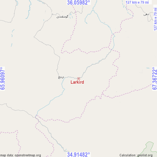
Larkird GPS coordinates[2]
35° 29' 21.696" North, 66° 39' 50.724" East
| Map corner | latitude | longitude |
|---|---|---|
| Upper-left | 36.05982°, | 65.96097° |
| Center: | 35.48936°, | 66.66409° |
| Lower-right: | 34.91482°, | 67.36722° |
| Map W x H: | 127.3×127.3 km | = 79.1×79.1mi |
| max Lat: | 38.4435° ⇑31.5% North |
| Larkird: | 35.48936° |
| min Lat: | ⇓68.5% South 30.15° |
| min Long | Larkird | max Long |
| 61.06667° | 66.66409° | 72.318° |
| W 35.4%⇐ | ⇒64.6% E |
Elevation
Elevation of Larkird is 1508 m = 4948 ft, and this is 89.6 m = 294 ft above average elevation for this country.
| Max E: |
3068 m = 10066 ft | 45.3% |
| Larkird | 1508 m 4948 ft | |
| Avg. | 1418.4 m = 4654 ft | |
Min E: |
254 m = 833 ft | 54.7% |
See also: Afghanistan elevation on elevation.city.
Geographical zone
Larkird is located in North temperate zone (between Tropic of Cancer and the Arctic Circle). Distance of this Northern Tropic circle is 1340.1 km =832.7 mi to South.| Distance of | km | miles | from Larkird |
|---|---|---|---|
| North Pole | 6061 | 3766.1 | to North |
| Arctic Circle | 3455.1 | 2146.9 | to North |
| Tropic Cancer | 1340.1 | 832.7 | to South |
| Equator | 3946 | 2451.9 | to South |


Nearby cities:
15 places around Larkird: (largest is in red/bold)
• Chīras
62.3 km =38.7 mi,  262°
262°
• Dehī
76.2 km =47.3 mi,  46°
46°
• Khudāydād Khēl
99.1 km =61.6 mi,  110°
110°
• Lab-Sar
61.7 km =38.3 mi,  14°
14°
• Nayak
88 km =54.7 mi,  162°
162°
• Pasnay
86.9 km =54 mi,  290°
290°
• Qal‘ah-ye Shahr
99.4 km =61.8 mi,  273°
273°
• Rū-ye Sang
89.9 km =55.9 mi,  102°
102°
• Sang-e Chārak
45 km =28 mi,  332°
332°
• Sar-e Pul
104.2 km =64.7 mi,  320°
320°
• Sōzmah Qal‘ah
79.3 km =49.3 mi, 328°
• Tagāw-Bāy
59.3 km =36.8 mi, 293°
• Tukzār
55.5 km =34.5 mi,  336°
336°
• Āq Kupruk
67.9 km =42.2 mi, 13°
• Şayād
104 km =64.6 mi,  313°
313°
Sources, notices
• [Note1] Compared only with cities in Afghanistan existing in our database
• [Src1] Map data: © OpenStreetMap contributors (CC-BY-SA)
• [Src2] Other city data from geonames.org with taken over terms of usage.
• [Src3] Geographical zone / Annual Mean Temperature by Robert A. Rohde @ Wikipedia
