Pasnay geodata
Pasnay (Sar-e Pol) is a seat of a second-order administrative division; located in Afghanistan in Asia/Kabul (GMT+4.5) time zone. In our database, there are 93 cities with bigger population. Compared to other cities in Afghanistan, 73.3% of cities are located further ↓South; 74% of cities are located further →East and 64.6% of cities have lower elevation than Pasnay. Note1


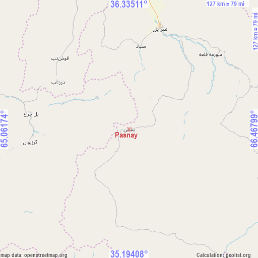
Pasnay GPS coordinates[2]
35° 45' 59.904" North, 65° 45' 53.496" East
| Map corner | latitude | longitude |
|---|---|---|
| Upper-left | 36.33511°, | 65.06174° |
| Center: | 35.76664°, | 65.76486° |
| Lower-right: | 35.19408°, | 66.46799° |
| Map W x H: | 126.9×126.9 km | = 78.9×78.9mi |
| max Lat: | 38.4435° ⇑26.7% North |
| Pasnay: | 35.76664° |
| min Lat: | ⇓73.3% South 30.15° |
| min Long | Pasnay | max Long |
| 61.06667° | 65.76486° | 72.318° |
| W 26%⇐ | ⇒74% E |
Elevation
Elevation of Pasnay is 1759 m = 5771 ft, and this is 340.6 m = 1117 ft above average elevation for this country.
| Max E: |
3068 m = 10066 ft | 35.4% |
| Pasnay | 1759 m 5771 ft | |
| Avg. | 1418.4 m = 4654 ft | |
Min E: |
254 m = 833 ft | 64.6% |
See also: Afghanistan elevation on elevation.city.
Geographical zone
Pasnay is located in North temperate zone (between Tropic of Cancer and the Arctic Circle). Distance of this Northern Tropic circle is 1371 km =851.9 mi to South.| Distance of | km | miles | from Pasnay |
|---|---|---|---|
| North Pole | 6030.2 | 3747 | to North |
| Arctic Circle | 3424.3 | 2127.8 | to North |
| Tropic Cancer | 1371 | 851.9 | to South |
| Equator | 3976.9 | 2471.1 | to South |


Nearby cities:
15 places around Pasnay: (largest is in red/bold)
• Bal Chirāgh
48.8 km =30.3 mi,  279°
279°
• Chīras
43.6 km =27.1 mi,  153°
153°
• Darzāb
42 km =26.1 mi,  303°
303°
• Fayẕābād
99.9 km =62.1 mi,  305°
305°
• Larkird
86.9 km =54 mi,  110°
110°
• Lāsh
99.4 km =61.8 mi,  244°
244°
• Maymana
90.1 km =56 mi, 281°
• Qal‘ah-ye Shahr
30.2 km =18.8 mi,  216°
216°
• Sang-e Chārak
61.3 km =38.1 mi,  81°
81°
• Sar Chakān
48.8 km =30.3 mi,  261°
261°
• Sar-e Pul
52.1 km =32.4 mi,  16°
16°
• Sōzmah Qal‘ah
54.4 km =33.8 mi,  47°
47°
• Tagāw-Bāy
27.8 km =17.3 mi, 105°
• Tukzār
62.5 km =38.8 mi,  71°
71°
• Şayād
41.4 km =25.7 mi,  8°
8°
Sources, notices
• [Note1] Compared only with cities in Afghanistan existing in our database
• [Src1] Map data: © OpenStreetMap contributors (CC-BY-SA)
• [Src2] Other city data from geonames.org with taken over terms of usage.
• [Src3] Geographical zone / Annual Mean Temperature by Robert A. Rohde @ Wikipedia
