Qurghān geodata
Qurghān (Faryab) is a seat of a second-order administrative division; located in Afghanistan in Asia/Kabul (GMT+4.5) time zone. In our database, there are 93 cities with bigger population. Compared to other cities in Afghanistan, 90% of cities are located further ↓South; 80.1% of cities are located further →East and 96.5% of cities have higher elevation than Qurghān. Note1


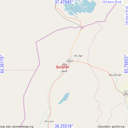
Qurghān GPS coordinates[2]
36° 55' 9.804" North, 65° 3' 53.64" East
| Map corner | latitude | longitude |
|---|---|---|
| Upper-left | 37.47945°, | 64.36178° |
| Center: | 36.91939°, | 65.0649° |
| Lower-right: | 36.35519°, | 65.76803° |
| Map W x H: | 125×125 km | = 77.7×77.7mi |
| max Lat: | 38.4435° ⇑10% North |
| Qurghān: | 36.91939° |
| min Lat: | ⇓90% South 30.15° |
| min Long | Qurghān | max Long |
| 61.06667° | 65.0649° | 72.318° |
| W 19.9%⇐ | ⇒80.1% E |
Elevation
Elevation of Qurghān is 312 m = 1024 ft, and this is 1106.4 m = 3630 ft below average elevation for this country.
| Max E: |
3068 m = 10066 ft | 96.5% |
| Avg. | 1418.4 m = 4654 ft | |
| Qurghān | 312 m = 1024 ft | |
Min E: |
254 m = 833 ft | 3.5% |
See also: Afghanistan elevation on elevation.city.
Geographical zone
Qurghān is located in North temperate zone (between Tropic of Cancer and the Arctic Circle). Distance of this Northern Tropic circle is 1499.1 km =931.5 mi to South.| Distance of | km | miles | from Qurghān |
|---|---|---|---|
| North Pole | 5902 | 3667.3 | to North |
| Arctic Circle | 3296.1 | 2048.1 | to North |
| Tropic Cancer | 1499.1 | 931.5 | to South |
| Equator | 4105.1 | 2550.8 | to South |


Nearby cities:
15 places around Qurghān: (largest is in red/bold)
• Andkhōy
6.4 km =4 mi,  54°
54°
• Chahār Bāgh
16.8 km =10.4 mi,  57°
57°
• Darzāb
108.4 km =67.4 mi,  165°
165°
• Dowlatābād
55.6 km =34.5 mi,  193°
193°
• Fayẕābād
72.2 km =44.9 mi, 194°
• Khamyāb
91.3 km =56.7 mi,  42°
42°
• Khwājah Dū Kōh
50.8 km =31.6 mi,  101°
101°
• Khānaqāh
98.2 km =61 mi,  93°
93°
• Mardīān
109.7 km =68.2 mi, 85°
• Mingajik
95.2 km =59.2 mi,  82°
82°
• Qaram Qōl
10.1 km =6.3 mi, 191°
• Qarqīn
103 km =64 mi, 57°
• Sar-e Pul
110.1 km =68.4 mi,  135°
135°
• Shibirghān
67.4 km =41.9 mi,  114°
114°
• Āqchah
99.5 km =61.8 mi, 90°
Sources, notices
• [Note1] Compared only with cities in Afghanistan existing in our database
• [Src1] Map data: © OpenStreetMap contributors (CC-BY-SA)
• [Src2] Other city data from geonames.org with taken over terms of usage.
• [Src3] Geographical zone / Annual Mean Temperature by Robert A. Rohde @ Wikipedia
