Chahār Bāgh geodata
Chahār Bāgh (Faryab) is a seat of a second-order administrative division; located in Afghanistan in Asia/Kabul (GMT+4.5) time zone. In our database, there are 93 cities with bigger population. Compared to other cities in Afghanistan, 92% of cities are located further ↓South; 79.1% of cities are located further →East and 99% of cities have higher elevation than Chahār Bāgh. Note1


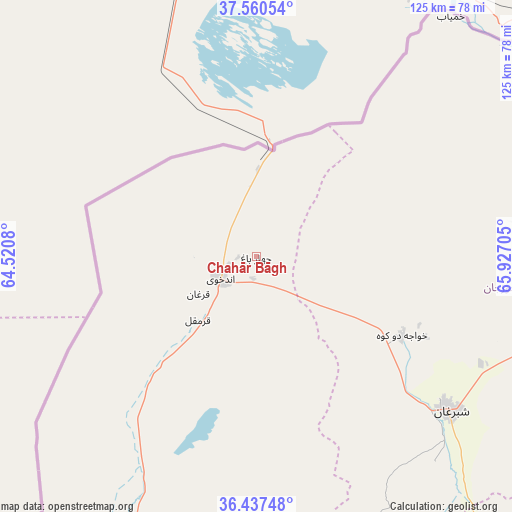
Chahār Bāgh GPS coordinates[2]
37° 0' 3.888" North, 65° 13' 26.112" East
| Map corner | latitude | longitude |
|---|---|---|
| Upper-left | 37.56054°, | 64.5208° |
| Center: | 37.00108°, | 65.22392° |
| Lower-right: | 36.43748°, | 65.92705° |
| Map W x H: | 124.9×124.9 km | = 77.6×77.6mi |
| max Lat: | 38.4435° ⇑8% North |
| Chahār Bāgh: | 37.00108° |
| min Lat: | ⇓92% South 30.15° |
| min Long | Chahār Bāgh | max Long |
| 61.06667° | 65.22392° | 72.318° |
| W 20.9%⇐ | ⇒79.1% E |
Elevation
Elevation of Chahār Bāgh is 284 m = 932 ft, and this is 1134.4 m = 3722 ft below average elevation for this country.
| Max E: |
3068 m = 10066 ft | 99% |
| Avg. | 1418.4 m = 4654 ft | |
| Chahār Bāgh | 284 m = 932 ft | |
Min E: |
254 m = 833 ft | 1% |
See also: Afghanistan elevation on elevation.city.
Geographical zone
Chahār Bāgh is located in North temperate zone (between Tropic of Cancer and the Arctic Circle). Distance of this Northern Tropic circle is 1508.2 km =937.2 mi to South.| Distance of | km | miles | from Chahār Bāgh |
|---|---|---|---|
| North Pole | 5892.9 | 3661.7 | to North |
| Arctic Circle | 3287 | 2042.4 | to North |
| Tropic Cancer | 1508.2 | 937.2 | to South |
| Equator | 4114.1 | 2556.4 | to South |


Nearby cities:
15 places around Chahār Bāgh: (largest is in red/bold)
• Andkhōy
10.4 km =6.5 mi,  238°
238°
• Dowlatābād
68.7 km =42.7 mi,  203°
203°
• Fayẕābād
85.3 km =53 mi, 202°
• Khamyāb
75.2 km =46.7 mi,  38°
38°
• Khwājah Dū Kōh
40.4 km =25.1 mi,  118°
118°
• Khānaqāh
85.2 km =52.9 mi,  100°
100°
• Mardīān
95.3 km =59.2 mi,  90°
90°
• Mingajik
80.3 km =49.9 mi, 87°
• Qaram Qōl
24.9 km =15.5 mi,  220°
220°
• Qarqīn
86.2 km =53.6 mi,  57°
57°
• Qurghān
16.8 km =10.4 mi, 237°
• Sar-e Pul
107.8 km =67 mi,  144°
144°
• Shibirghān
59.9 km =37.2 mi,  128°
128°
• Āqchah
85.9 km =53.4 mi, 97°
• Şayād
110.4 km =68.6 mi,  150°
150°
Sources, notices
• [Note1] Compared only with cities in Afghanistan existing in our database
• [Src1] Map data: © OpenStreetMap contributors (CC-BY-SA)
• [Src2] Other city data from geonames.org with taken over terms of usage.
• [Src3] Geographical zone / Annual Mean Temperature by Robert A. Rohde @ Wikipedia
