Khamyāb geodata
Khamyāb (Jowzjan) is a seat of a second-order administrative division; located in Afghanistan in Asia/Kabul (GMT+4.5) time zone. In our database, there are 93 cities with bigger population. Compared to other cities in Afghanistan, 98.1% of cities are located further ↓South; 74.3% of cities are located further →East and 100% of cities have higher elevation than Khamyāb. Note1


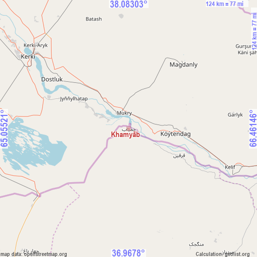
Khamyāb GPS coordinates[2]
37° 31' 39" North, 65° 45' 29.988" East
| Map corner | latitude | longitude |
|---|---|---|
| Upper-left | 38.08303°, | 65.05521° |
| Center: | 37.5275°, | 65.75833° |
| Lower-right: | 36.9678°, | 66.46146° |
| Map W x H: | 124×124 km | = 77.1×77.1mi |
| max Lat: | 38.4435° ⇑1.9% North |
| Khamyāb: | 37.5275° |
| min Lat: | ⇓98.1% South 30.15° |
| min Long | Khamyāb | max Long |
| 61.06667° | 65.75833° | 72.318° |
| W 25.7%⇐ | ⇒74.3% E |
Elevation
Elevation of Khamyāb is 254 m = 833 ft, and this is 1164.4 m = 3820 ft below average elevation for this country.
| Max E: |
3068 m = 10066 ft | 100% |
| Avg. | 1418.4 m = 4654 ft | |
| Khamyāb | 254 m = 833 ft | |
Min E: |
254 m = 833 ft | 0% |
See also: Afghanistan elevation on elevation.city.
Geographical zone
Khamyāb is located in North temperate zone (between Tropic of Cancer and the Arctic Circle). Distance of this Northern Tropic circle is 1566.7 km =973.5 mi to South.| Distance of | km | miles | from Khamyāb |
|---|---|---|---|
| North Pole | 5834.4 | 3625.3 | to North |
| Arctic Circle | 3228.5 | 2006.1 | to North |
| Tropic Cancer | 1566.7 | 973.5 | to South |
| Equator | 4172.7 | 2592.8 | to South |


Nearby cities:
15 places around Khamyāb: (largest is in red/bold)
• Andkhōy
85.1 km =52.9 mi,  221°
221°
• Chahār Bāgh
75.2 km =46.7 mi, 218°
• Chimtāl
132.3 km =82.2 mi,  135°
135°
• Dowlatābād
111.5 km =69.3 mi,  122°
122°
• Faīẕābād
100.1 km =62.2 mi, 141°
• Khwājah Dū Kōh
78.6 km =48.8 mi,  188°
188°
• Khānaqāh
82.3 km =51.1 mi,  153°
153°
• Mardīān
76.2 km =47.3 mi, 141°
• Mingajik
64.5 km =40.1 mi, 149°
• Qaram Qōl
100.1 km =62.2 mi, 219°
• Qarchī Gak
106.1 km =65.9 mi, 120°
• Qarqīn
27.9 km =17.3 mi, 115°
• Qurghān
91.3 km =56.7 mi, 222°
• Shibirghān
95.6 km =59.4 mi,  180°
180°
• Āqchah
78.8 km =49 mi, 151°
Sources, notices
• [Note1] Compared only with cities in Afghanistan existing in our database
• [Src1] Map data: © OpenStreetMap contributors (CC-BY-SA)
• [Src2] Other city data from geonames.org with taken over terms of usage.
• [Src3] Geographical zone / Annual Mean Temperature by Robert A. Rohde @ Wikipedia
