Lāsh geodata
Lāsh (Faryab) is a seat of a second-order administrative division; located in Afghanistan in Asia/Kabul (GMT+4.5) time zone. In our database, there are 93 cities with bigger population. Compared to other cities in Afghanistan, 66.9% of cities are located further ↓South; 83% of cities are located further →East and 70.7% of cities have lower elevation than Lāsh. Note1


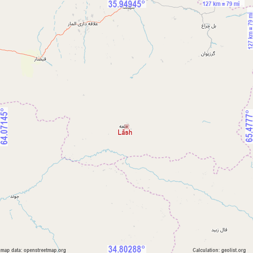
Lāsh GPS coordinates[2]
35° 22' 41.52" North, 64° 46' 28.452" East
| Map corner | latitude | longitude |
|---|---|---|
| Upper-left | 35.94945°, | 64.07145° |
| Center: | 35.3782°, | 64.77457° |
| Lower-right: | 34.80288°, | 65.4777° |
| Map W x H: | 127.5×127.5 km | = 79.2×79.2mi |
| max Lat: | 38.4435° ⇑33.1% North |
| Lāsh: | 35.3782° |
| min Lat: | ⇓66.9% South 30.15° |
| min Long | Lāsh | max Long |
| 61.06667° | 64.77457° | 72.318° |
| W 17%⇐ | ⇒83% E |
Elevation
Elevation of Lāsh is 1927 m = 6322 ft, and this is 508.6 m = 1669 ft above average elevation for this country.
| Max E: |
3068 m = 10066 ft | 29.3% |
| Lāsh | 1927 m 6322 ft | |
| Avg. | 1418.4 m = 4654 ft | |
Min E: |
254 m = 833 ft | 70.7% |
See also: Afghanistan elevation on elevation.city.
Geographical zone
Lāsh is located in North temperate zone (between Tropic of Cancer and the Arctic Circle). Distance of this Northern Tropic circle is 1327.8 km =825.1 mi to South.| Distance of | km | miles | from Lāsh |
|---|---|---|---|
| North Pole | 6073.4 | 3773.8 | to North |
| Arctic Circle | 3467.5 | 2154.6 | to North |
| Tropic Cancer | 1327.8 | 825.1 | to South |
| Equator | 3933.7 | 2444.3 | to South |


Nearby cities:
15 places around Lāsh: (largest is in red/bold)
• Bal Chirāgh
65.9 km =40.9 mi,  38°
38°
• Chīras
109.6 km =68.1 mi,  87°
87°
• Darzāb
86.1 km =53.5 mi, 39°
• Dowlatābād
118 km =73.3 mi,  6°
6°
• Fayrōz Kōh
104.9 km =65.2 mi,  155°
155°
• Fayẕābād
101.8 km =63.3 mi,  4°
4°
• Ghormach
97.9 km =60.8 mi,  293°
293°
• Jawand
66.7 km =41.4 mi,  238°
238°
• Maymana
60.4 km =37.5 mi, 0°
• Pasnay
99.4 km =61.8 mi,  64°
64°
• Qal‘ah-ye Shahr
74.2 km =46.1 mi,  75°
75°
• Sangalak-i-Kaisar
55.5 km =34.5 mi,  308°
308°
• Sar Chakān
54.7 km =34 mi,  48°
48°
• Tagāw-Bāy
121.8 km =75.7 mi,  72°
72°
• ‘Alāqahdārī-ye Almār
56.5 km =35.1 mi,  337°
337°
Sources, notices
• [Note1] Compared only with cities in Afghanistan existing in our database
• [Src1] Map data: © OpenStreetMap contributors (CC-BY-SA)
• [Src2] Other city data from geonames.org with taken over terms of usage.
• [Src3] Geographical zone / Annual Mean Temperature by Robert A. Rohde @ Wikipedia
