Maymana geodata
Maymana (Faryab) is a seat of a first-order administrative division; located in Afghanistan in Asia/Kabul (GMT+4.5) time zone. With population of 75,900 people, there are 11 cities with bigger population in this country. Compared to other cities in Afghanistan, 74.9% of cities are located further ↓South; 82.6% of cities are located further →East and 73.6% of cities have higher elevation than Maymana. Note1


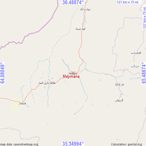
Maymana GPS coordinates[2]
35° 55' 17.004" North, 64° 47' 0.996" East
| Map corner | latitude | longitude |
|---|---|---|
| Upper-left | 36.48874°, | 64.08049° |
| Center: | 35.92139°, | 64.78361° |
| Lower-right: | 35.34994°, | 65.48674° |
| Map W x H: | 126.6×126.6 km | = 78.7×78.7mi |
| max Lat: | 38.4435° ⇑25.1% North |
| Maymana: | 35.92139° |
| min Lat: | ⇓74.9% South 30.15° |
| min Long | Maymana | max Long |
| 61.06667° | 64.78361° | 72.318° |
| W 17.4%⇐ | ⇒82.6% E |
Elevation
Elevation of Maymana is 864 m = 2835 ft, and this is 554.4 m = 1819 ft below average elevation for this country.
| Max E: |
3068 m = 10066 ft | 73.6% |
| Avg. | 1418.4 m = 4654 ft | |
| Maymana | 864 m = 2835 ft | |
Min E: |
254 m = 833 ft | 26.4% |
See also: Maymana elevation on elevation.city.
Geographical zone
Maymana is located in North temperate zone (between Tropic of Cancer and the Arctic Circle). Distance of this Northern Tropic circle is 1388.2 km =862.6 mi to South.| Distance of | km | miles | from Maymana |
|---|---|---|---|
| North Pole | 6013 | 3736.3 | to North |
| Arctic Circle | 3407.1 | 2117.1 | to North |
| Tropic Cancer | 1388.2 | 862.6 | to South |
| Equator | 3994.1 | 2481.8 | to South |


Nearby cities:
15 places around Maymana: (largest is in red/bold)
• Bal Chirāgh
41.3 km =25.7 mi,  102°
102°
• Darzāb
53.9 km =33.5 mi,  83°
83°
• Dowlatābād
58.2 km =36.2 mi,  12°
12°
• Fayẕābād
41.7 km =25.9 mi, 9°
• Ghormach
92.7 km =57.6 mi,  256°
256°
• Jawand
111.3 km =69.2 mi,  211°
211°
• Lāsh
60.4 km =37.5 mi,  180°
180°
• Pasnay
90.1 km =56 mi, 101°
• Qal‘ah-ye Shahr
82.1 km =51 mi,  120°
120°
• Qaram Qōl
103.7 km =64.4 mi, 12°
• Sangalak-i-Kaisar
51.3 km =31.9 mi,  239°
239°
• Sar Chakān
47.1 km =29.3 mi, 121°
• Sar-e Pul
108.3 km =67.3 mi,  72°
72°
• Şayād
97 km =60.3 mi, 75°
• ‘Alāqahdārī-ye Almār
24.3 km =15.1 mi,  249°
249°
In other languages:
- In Spanish: Maymanah
- In France: Maïmana
- In Italian: Meymaneh
- In Russian: Меймене
- In Chinese: 迈马纳
Sources, notices
• [Note1] Compared only with cities in Afghanistan existing in our database
• [Src1] Map data: © OpenStreetMap contributors (CC-BY-SA)
• [Src2] Other city data from geonames.org with taken over terms of usage.
• [Src3] Geographical zone / Annual Mean Temperature by Robert A. Rohde @ Wikipedia
