Quchanghī geodata
Quchanghī (Daykundi) is a seat of a second-order administrative division; located in Afghanistan in Asia/Kabul (GMT+4.5) time zone. In our database, there are 93 cities with bigger population. Compared to other cities in Afghanistan, 65.6% of cities are located further ↑North; 68.5% of cities are located further →East and 91.6% of cities have lower elevation than Quchanghī. Note1


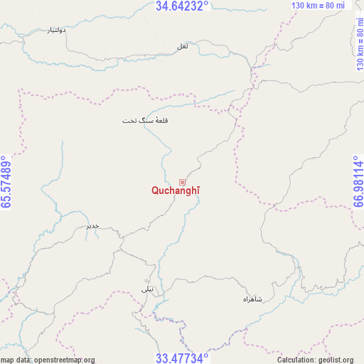
Quchanghī GPS coordinates[2]
34° 3' 42.588" North, 66° 16' 40.836" East
| Map corner | latitude | longitude |
|---|---|---|
| Upper-left | 34.64232°, | 65.57489° |
| Center: | 34.06183°, | 66.27801° |
| Lower-right: | 33.47734°, | 66.98114° |
| Map W x H: | 129.5×129.5 km | = 80.5×80.5mi |
| max Lat: | 38.4435° ⇑65.6% North |
| Quchanghī: | 34.06183° |
| min Lat: | ⇓34.4% South 30.15° |
| min Long | Quchanghī | max Long |
| 61.06667° | 66.27801° | 72.318° |
| W 31.5%⇐ | ⇒68.5% E |
Elevation
Elevation of Quchanghī is 2456 m = 8058 ft, and this is 1037.6 m = 3404 ft above average elevation for this country.
| Max E: |
3068 m = 10066 ft | 8.4% |
| Quchanghī | 2456 m 8058 ft | |
| Avg. | 1418.4 m = 4654 ft | |
Min E: |
254 m = 833 ft | 91.6% |
See also: Afghanistan elevation on elevation.city.
Geographical zone
Quchanghī is located in North temperate zone (between Tropic of Cancer and the Arctic Circle). Distance of this Northern Tropic circle is 1181.4 km =734.1 mi to South.| Distance of | km | miles | from Quchanghī |
|---|---|---|---|
| North Pole | 6219.7 | 3864.7 | to North |
| Arctic Circle | 3613.9 | 2245.6 | to North |
| Tropic Cancer | 1181.4 | 734.1 | to South |
| Equator | 3787.3 | 2353.3 | to South |


Nearby cities:
15 places around Quchanghī: (largest is in red/bold)
• Chowṉêy
75.5 km =46.9 mi,  180°
180°
• Dowlatyār
70.3 km =43.7 mi,  320°
320°
• Dū Laīnah
137.8 km =85.6 mi,  274°
274°
• Fayrōz Kōh
107.2 km =66.6 mi,  298°
298°
• Kajrān
121.1 km =75.2 mi,  217°
217°
• Khadīr
35.3 km =21.9 mi,  243°
243°
• La‘l
48.9 km =30.4 mi,  0°
0°
• Nayak
97.1 km =60.3 mi,  39°
39°
• Nīlī
40.2 km =25 mi,  199°
199°
• Panjāb
77.5 km =48.2 mi,  62°
62°
• Pasāband
137.9 km =85.7 mi,  252°
252°
• Sang-e Māshah
148.7 km =92.4 mi,  133°
133°
• Sar-e Tayghān
82.8 km =51.4 mi, 222°
• Uruzgān
130.3 km =81 mi,  165°
165°
• Wulêswālī Bihsūd
152.9 km =95 mi,  78°
78°
Sources, notices
• [Note1] Compared only with cities in Afghanistan existing in our database
• [Src1] Map data: © OpenStreetMap contributors (CC-BY-SA)
• [Src2] Other city data from geonames.org with taken over terms of usage.
• [Src3] Geographical zone / Annual Mean Temperature by Robert A. Rohde @ Wikipedia
