Sangalak-i-Kaisar geodata
Sangalak-i-Kaisar (Faryab) is a seat of a second-order administrative division; located in Afghanistan in Asia/Kabul (GMT+4.5) time zone. In our database, there are 93 cities with bigger population. Compared to other cities in Afghanistan, 71.7% of cities are located further ↓South; 85.5% of cities are located further →East and 54.7% of cities have higher elevation than Sangalak-i-Kaisar. Note1


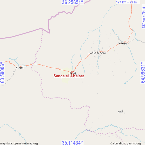
Sangalak-i-Kaisar GPS coordinates[2]
35° 41' 14.892" North, 64° 17' 35.448" East
| Map corner | latitude | longitude |
|---|---|---|
| Upper-left | 36.25651°, | 63.59006° |
| Center: | 35.68747°, | 64.29318° |
| Lower-right: | 35.11434°, | 64.99631° |
| Map W x H: | 127×127 km | = 78.9×78.9mi |
| max Lat: | 38.4435° ⇑28.3% North |
| Sangalak-i-Kaisar: | 35.68747° |
| min Lat: | ⇓71.7% South 30.15° |
| min Long | Sangalak-i-Kais | max Long |
| 61.06667° | 64.29318° | 72.318° |
| W 14.5%⇐ | ⇒85.5% E |
Elevation
Elevation of Sangalak-i-Kaisar is 1258 m = 4127 ft, and this is 160.4 m = 526 ft below average elevation for this country.
| Max E: |
3068 m = 10066 ft | 54.7% |
| Avg. | 1418.4 m = 4654 ft | |
| Sangalak-i-Kaisar | 1258 m = 4127 ft | |
Min E: |
254 m = 833 ft | 45.3% |
See also: Afghanistan elevation on elevation.city.
Geographical zone
Sangalak-i-Kaisar is located in North temperate zone (between Tropic of Cancer and the Arctic Circle). Distance of this Northern Tropic circle is 1362.2 km =846.4 mi to South.| Distance of | km | miles | from Sangalak-i-Kaisar |
|---|---|---|---|
| North Pole | 6039 | 3752.5 | to North |
| Arctic Circle | 3433.1 | 2133.2 | to North |
| Tropic Cancer | 1362.2 | 846.4 | to South |
| Equator | 3968.1 | 2465.7 | to South |


Nearby cities:
15 places around Sangalak-i-Kaisar: (largest is in red/bold)
• Bal Chirāgh
86.3 km =53.6 mi,  78°
78°
• Bala Murghab
87.9 km =54.6 mi,  262°
262°
• Darzāb
103 km =64 mi,  71°
71°
• Dowlatābād
100.2 km =62.3 mi,  34°
34°
• Fayẕābād
84.4 km =52.4 mi,  37°
37°
• Ghormach
46.3 km =28.8 mi,  275°
275°
• Jawand
70.6 km =43.9 mi,  190°
190°
• Lāsh
55.5 km =34.5 mi,  128°
128°
• Maymana
51.3 km =31.9 mi,  59°
59°
• Qal‘ah-ye Shahr
116.2 km =72.2 mi,  97°
97°
• Qādis
125.3 km =77.9 mi,  218°
218°
• Sang Atesh
126.5 km =78.6 mi,  247°
247°
• Sar Chakān
84.7 km =52.6 mi,  88°
88°
• Āb-e Kamarī
129.5 km =80.5 mi,  239°
239°
• ‘Alāqahdārī-ye Almār
27.8 km =17.3 mi,  50°
50°
Sources, notices
• [Note1] Compared only with cities in Afghanistan existing in our database
• [Src1] Map data: © OpenStreetMap contributors (CC-BY-SA)
• [Src2] Other city data from geonames.org with taken over terms of usage.
• [Src3] Geographical zone / Annual Mean Temperature by Robert A. Rohde @ Wikipedia
