Ghormach geodata
Ghormach (Badghis) is a seat of a second-order administrative division; located in Afghanistan in Asia/Kabul (GMT+4.5) time zone. With population of 30,000 people, there are 29 cities with bigger population in this country. Compared to other cities in Afghanistan, 73% of cities are located further ↓South; 88.1% of cities are located further →East and 82.6% of cities have higher elevation than Ghormach. Note1


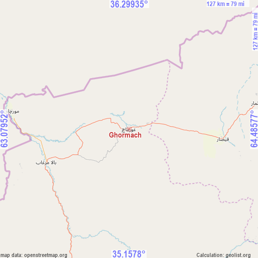
Ghormach GPS coordinates[2]
35° 43' 50.232" North, 63° 46' 57.504" East
| Map corner | latitude | longitude |
|---|---|---|
| Upper-left | 36.29935°, | 63.07952° |
| Center: | 35.73062°, | 63.78264° |
| Lower-right: | 35.1578°, | 64.48577° |
| Map W x H: | 126.9×126.9 km | = 78.9×78.9mi |
| max Lat: | 38.4435° ⇑27% North |
| Ghormach: | 35.73062° |
| min Lat: | ⇓73% South 30.15° |
| min Long | Ghormach | max Long |
| 61.06667° | 63.78264° | 72.318° |
| W 11.9%⇐ | ⇒88.1% E |
Elevation
Elevation of Ghormach is 659 m = 2162 ft, and this is 759.4 m = 2491 ft below average elevation for this country.
| Max E: |
3068 m = 10066 ft | 82.6% |
| Avg. | 1418.4 m = 4654 ft | |
| Ghormach | 659 m = 2162 ft | |
Min E: |
254 m = 833 ft | 17.4% |
See also: Afghanistan elevation on elevation.city.
Geographical zone
Ghormach is located in North temperate zone (between Tropic of Cancer and the Arctic Circle). Distance of this Northern Tropic circle is 1367 km =849.4 mi to South.| Distance of | km | miles | from Ghormach |
|---|---|---|---|
| North Pole | 6034.2 | 3749.5 | to North |
| Arctic Circle | 3428.3 | 2130.2 | to North |
| Tropic Cancer | 1367 | 849.4 | to South |
| Equator | 3972.9 | 2468.6 | to South |


Nearby cities:
15 places around Ghormach: (largest is in red/bold)
• Bal Chirāgh
131.2 km =81.5 mi,  84°
84°
• Bala Murghab
44.1 km =27.4 mi,  248°
248°
• Darzāb
146.4 km =91 mi, 79°
• Dowlatābād
128.6 km =79.9 mi,  52°
52°
• Fayẕābād
115.4 km =71.7 mi,  57°
57°
• Jawand
81.3 km =50.5 mi,  155°
155°
• Lāsh
97.9 km =60.8 mi,  113°
113°
• Maymana
92.7 km =57.6 mi, 76°
• Qala i Naw
101.7 km =63.2 mi,  215°
215°
• Qādis
107.4 km =66.7 mi,  197°
197°
• Sang Atesh
88.6 km =55.1 mi,  232°
232°
• Sangalak-i-Kaisar
46.3 km =28.8 mi,  95°
95°
• Sar Chakān
130.8 km =81.3 mi,  91°
91°
• Āb-e Kamarī
96.4 km =59.9 mi, 222°
• ‘Alāqahdārī-ye Almār
68.7 km =42.7 mi, 79°
Sources, notices
• [Note1] Compared only with cities in Afghanistan existing in our database
• [Src1] Map data: © OpenStreetMap contributors (CC-BY-SA)
• [Src2] Other city data from geonames.org with taken over terms of usage.
• [Src3] Geographical zone / Annual Mean Temperature by Robert A. Rohde @ Wikipedia
