‚ÄėAlńĀqahdńĀrńę-ye AlmńĀr geodata
‚ÄėAlńĀqahdńĀrńę-ye AlmńĀr (Faryab) is a seat of a second-order administrative division; located in Afghanistan in Asia/Kabul (GMT+4.5) time zone. In our database, there are 93 cities with bigger population. Compared to other cities in Afghanistan, 74% of cities are located further ↓South; 83.9% of cities are located further →East and 74% of cities have higher elevation than ‚ÄėAlńĀqahdńĀrńę-ye AlmńĀr. Note1
Current local time in ‚ÄėAlńĀqahdńĀrńę-ye AlmńĀr:
11:30 PM, TuesdayDifference from your time zone: hours


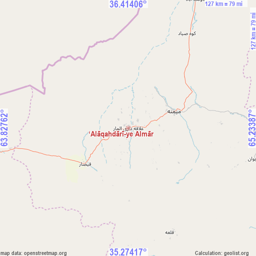
‚ÄėAlńĀqahdńĀrńę-ye AlmńĀr GPS coordinates[2]
35° 50' 46.176" North, 64° 31' 50.664" East
| Map corner | latitude | longitude |
|---|---|---|
| Upper-left | 36.41406°, | 63.82762° |
| Center: | 35.84616°, | 64.53074° |
| Lower-right: | 35.27417°, | 65.23387° |
| Map W x H: | 126.7×126.7 km | = 78.7√ó78.7mi |
| max Lat: | 38.4435° ⇑26% North |
| ‚ÄėAlńĀqahdńĀrńę-ye AlmńĀr: | 35.84616° |
| min Lat: | ⇓74% South 30.15° |
| min Long | ‚ÄėAlńĀqahdńĀrń | max Long |
| 61.06667° | 64.53074° | 72.318° |
| W 16.1%⇐ | ⇒83.9% E |
Elevation
Elevation of ‚ÄėAlńĀqahdńĀrńę-ye AlmńĀr is 840 m = 2756 ft, and this is 578.4 m = 1898 ft below average elevation for this country.
| Max E: |
3068 m = 10066 ft | 74% |
| Avg. | 1418.4 m = 4654 ft | |
| ‚ÄėAlńĀqahdńĀrńę-ye AlmńĀr | 840 m = 2756 ft | |
Min E: |
254 m = 833 ft | 26% |
See also: Afghanistan elevation on elevation.city.
Geographical zone
‚ÄėAlńĀqahdńĀrńę-ye AlmńĀr is located in North temperate zone (between Tropic of Cancer and the Arctic Circle). Distance of this Northern Tropic circle is 1379.8 km =857.4 mi to South.| Distance of | km | miles | from ‚ÄėAlńĀqahdńĀrńę-ye AlmńĀr |
|---|---|---|---|
| North Pole | 6021.3 | 3741.5 | to North |
| Arctic Circle | 3415.5 | 2122.3 | to North |
| Tropic Cancer | 1379.8 | 857.4 | to South |
| Equator | 3985.7 | 2476.6 | to South |


Nearby cities:
15 places around ‚ÄėAlńĀqahdńĀrńę-ye AlmńĀr: (largest is in red/bold)
• Bal ChirńĀgh
63.1 km =39.2 mi,  90°
90°
• Bala Murghab
112.3 km =69.8 mi,  254°
254°
• DarzńĀb
77.7 km =48.3 mi,  79°
79°
• DowlatńĀbńĀd
74 km =46 mi,  28°
28°
• FayŠļēńĀbńĀd
57.8 km =35.9 mi, 31°
• Ghormach
68.7 km =42.7 mi,  259°
259°
• Jawand
93.6 km =58.2 mi,  201°
201°
• LńĀsh
56.5 km =35.1 mi,  157°
157°
• Maymana
24.3 km =15.1 mi,  69°
69°
• Pasnay
111.6 km =69.3 mi, 94°
• Qal‚Äėah-ye Shahr
99.3 km =61.7 mi,  109°
109°
• Qaram QŇćl
118.6 km =73.7 mi,  22°
22°
• Sangalak-i-Kaisar
27.8 km =17.3 mi,  230°
230°
• Sar ChakńĀn
65.1 km =40.5 mi,  104°
104°
• ŇěayńĀd
121.2 km =75.3 mi, 74°
Sources, notices
• [Note1] Compared only with cities in Afghanistan existing in our database
• [Src1] Map data: © OpenStreetMap contributors (CC-BY-SA)
• [Src2] Other city data from geonames.org with taken over terms of usage.
• [Src3] Geographical zone / Annual Mean Temperature by Robert A. Rohde @ Wikipedia
