Jawand geodata
Jawand (Badghis) is a seat of a second-order administrative division; located in Afghanistan in Asia/Kabul (GMT+4.5) time zone. In our database, there are 93 cities with bigger population. Compared to other cities in Afghanistan, 62.7% of cities are located further ↓South; 86.5% of cities are located further →East and 69.1% of cities have higher elevation than Jawand. Note1


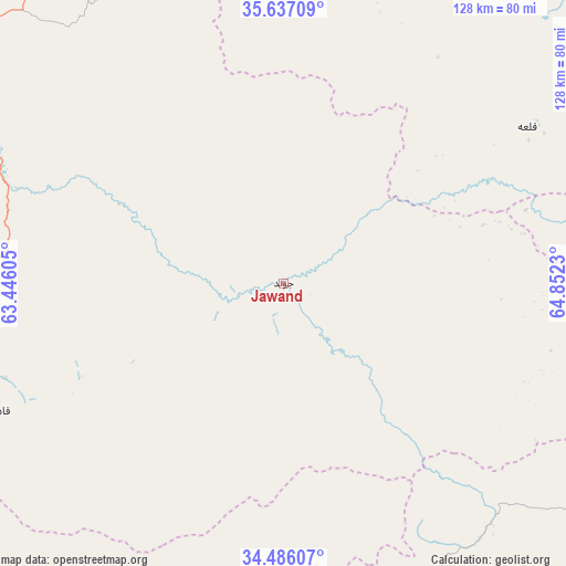
Jawand GPS coordinates[2]
35° 3' 48.996" North, 64° 8' 57.012" East
| Map corner | latitude | longitude |
|---|---|---|
| Upper-left | 35.63709°, | 63.44605° |
| Center: | 35.06361°, | 64.14917° |
| Lower-right: | 34.48607°, | 64.8523° |
| Map W x H: | 128×128 km | = 79.5×79.5mi |
| max Lat: | 38.4435° ⇑37.3% North |
| Jawand: | 35.06361° |
| min Lat: | ⇓62.7% South 30.15° |
| min Long | Jawand | max Long |
| 61.06667° | 64.14917° | 72.318° |
| W 13.5%⇐ | ⇒86.5% E |
Elevation
Elevation of Jawand is 945 m = 3100 ft, and this is 473.4 m = 1553 ft below average elevation for this country.
| Max E: |
3068 m = 10066 ft | 69.1% |
| Avg. | 1418.4 m = 4654 ft | |
| Jawand | 945 m = 3100 ft | |
Min E: |
254 m = 833 ft | 30.9% |
See also: Afghanistan elevation on elevation.city.
Geographical zone
Jawand is located in North temperate zone (between Tropic of Cancer and the Arctic Circle). Distance of this Northern Tropic circle is 1292.8 km =803.3 mi to South.| Distance of | km | miles | from Jawand |
|---|---|---|---|
| North Pole | 6108.4 | 3795.6 | to North |
| Arctic Circle | 3502.5 | 2176.4 | to North |
| Tropic Cancer | 1292.8 | 803.3 | to South |
| Equator | 3898.7 | 2422.5 | to South |


Nearby cities:
15 places around Jawand: (largest is in red/bold)
• Bala Murghab
94.3 km =58.6 mi,  307°
307°
• Chisht-e Sharīf
88 km =54.7 mi,  205°
205°
• Dū Laīnah
116.5 km =72.4 mi,  150°
150°
• Fayrōz Kōh
117.4 km =72.9 mi,  121°
121°
• Ghormach
81.3 km =50.5 mi,  335°
335°
• Lāsh
66.7 km =41.4 mi,  58°
58°
• Maymana
111.3 km =69.2 mi,  31°
31°
• Qala i Naw
93.3 km =58 mi,  264°
264°
• Qaryeh-ye Owbeh
117.7 km =73.1 mi,  229°
229°
• Qādis
71.4 km =44.4 mi,  246°
246°
• Sang Atesh
106.1 km =65.9 mi,  281°
281°
• Sangalak-i-Kaisar
70.6 km =43.9 mi,  10°
10°
• Shahrak
107.3 km =66.7 mi,  172°
172°
• Āb-e Kamarī
98.4 km =61.1 mi,  271°
271°
• ‘Alāqahdārī-ye Almār
93.6 km =58.2 mi,  21°
21°
Sources, notices
• [Note1] Compared only with cities in Afghanistan existing in our database
• [Src1] Map data: © OpenStreetMap contributors (CC-BY-SA)
• [Src2] Other city data from geonames.org with taken over terms of usage.
• [Src3] Geographical zone / Annual Mean Temperature by Robert A. Rohde @ Wikipedia
