Qādis geodata
Qādis (Badghis) is a seat of a second-order administrative division; located in Afghanistan in Asia/Kabul (GMT+4.5) time zone. In our database, there are 93 cities with bigger population. Compared to other cities in Afghanistan, 54% of cities are located further ↓South; 89.4% of cities are located further →East and 52.4% of cities have higher elevation than Qādis. Note1


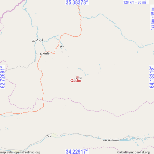
Qādis GPS coordinates[2]
34° 48' 30.6" North, 63° 25' 48.108" East
| Map corner | latitude | longitude |
|---|---|---|
| Upper-left | 35.38378°, | 62.72691° |
| Center: | 34.8085°, | 63.43003° |
| Lower-right: | 34.22917°, | 64.13316° |
| Map W x H: | 128.4×128.4 km | = 79.8×79.8mi |
| max Lat: | 38.4435° ⇑46% North |
| Qādis: | 34.8085° |
| min Lat: | ⇓54% South 30.15° |
| min Long | Qādis | max Long |
| 61.06667° | 63.43003° | 72.318° |
| W 10.6%⇐ | ⇒89.4% E |
Elevation
Elevation of Qādis is 1300 m = 4265 ft, and this is 118.4 m = 388 ft below average elevation for this country.
| Max E: |
3068 m = 10066 ft | 52.4% |
| Avg. | 1418.4 m = 4654 ft | |
| Qādis | 1300 m = 4265 ft | |
Min E: |
254 m = 833 ft | 47.6% |
See also: Afghanistan elevation on elevation.city.
Geographical zone
Qādis is located in North temperate zone (between Tropic of Cancer and the Arctic Circle). Distance of this Northern Tropic circle is 1264.4 km =785.7 mi to South.| Distance of | km | miles | from Qādis |
|---|---|---|---|
| North Pole | 6136.7 | 3813.2 | to North |
| Arctic Circle | 3530.8 | 2193.9 | to North |
| Tropic Cancer | 1264.4 | 785.7 | to South |
| Equator | 3870.3 | 2404.9 | to South |


Nearby cities:
15 places around Qādis: (largest is in red/bold)
• Bala Murghab
86.7 km =53.9 mi,  353°
353°
• Chisht-e Sharīf
58.6 km =36.4 mi,  151°
151°
• Ghormach
107.4 km =66.7 mi,  17°
17°
• Injīl
122.2 km =75.9 mi,  242°
242°
• Jawand
71.4 km =44.4 mi,  66°
66°
• Karukh
85.3 km =53 mi, 244°
• Kushk-e Kuhnah
80.8 km =50.2 mi,  274°
274°
• Qala i Naw
33.9 km =21.1 mi,  305°
305°
• Qal‘ah-ye Fārsī
115 km =71.5 mi,  188°
188°
• Qaryeh-ye Owbeh
54 km =33.6 mi,  205°
205°
• Rabāţ-e Sangī-ye Pā’īn
117.9 km =73.3 mi, 269°
• Sang Atesh
62.4 km =38.8 mi,  321°
321°
• Shahrak
111.9 km =69.5 mi,  134°
134°
• Tūlak
96.6 km =60 mi,  163°
163°
• Āb-e Kamarī
45.3 km =28.1 mi, 313°
Sources, notices
• [Note1] Compared only with cities in Afghanistan existing in our database
• [Src1] Map data: © OpenStreetMap contributors (CC-BY-SA)
• [Src2] Other city data from geonames.org with taken over terms of usage.
• [Src3] Geographical zone / Annual Mean Temperature by Robert A. Rohde @ Wikipedia
