Bala Murghab geodata
Bala Murghab (Badghis) is a seat of a second-order administrative division; located in Afghanistan in Asia/Kabul (GMT+4.5) time zone. In our database, there are 93 cities with bigger population. Compared to other cities in Afghanistan, 69.5% of cities are located further ↓South; 89.7% of cities are located further →East and 90% of cities have higher elevation than Bala Murghab. Note1


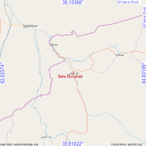
Bala Murghab GPS coordinates[2]
35° 35' 2.688" North, 63° 19' 43.896" East
| Map corner | latitude | longitude |
|---|---|---|
| Upper-left | 36.15386°, | 62.62574° |
| Center: | 35.58408°, | 63.32886° |
| Lower-right: | 35.01022°, | 64.03199° |
| Map W x H: | 127.2×127.2 km | = 79×79mi |
| max Lat: | 38.4435° ⇑30.5% North |
| Bala Murghab: | 35.58408° |
| min Lat: | ⇓69.5% South 30.15° |
| min Long | Bala Murghab | max Long |
| 61.06667° | 63.32886° | 72.318° |
| W 10.3%⇐ | ⇒89.7% E |
Elevation
Elevation of Bala Murghab is 466 m = 1529 ft, and this is 952.4 m = 3125 ft below average elevation for this country.
| Max E: |
3068 m = 10066 ft | 90% |
| Avg. | 1418.4 m = 4654 ft | |
| Bala Murghab | 466 m = 1529 ft | |
Min E: |
254 m = 833 ft | 10% |
See also: Afghanistan elevation on elevation.city.
Geographical zone
Bala Murghab is located in North temperate zone (between Tropic of Cancer and the Arctic Circle). Distance of this Northern Tropic circle is 1350.7 km =839.3 mi to South.| Distance of | km | miles | from Bala Murghab |
|---|---|---|---|
| North Pole | 6050.5 | 3759.6 | to North |
| Arctic Circle | 3444.6 | 2140.4 | to North |
| Tropic Cancer | 1350.7 | 839.3 | to South |
| Equator | 3956.6 | 2458.5 | to South |


Nearby cities:
15 places around Bala Murghab: (largest is in red/bold)
• Chisht-e Sharīf
142.5 km =88.5 mi,  164°
164°
• Ghormach
44.1 km =27.4 mi,  68°
68°
• Jawand
94.3 km =58.6 mi,  127°
127°
• Karukh
140 km =87 mi,  208°
208°
• Kushk-e Kuhnah
106.4 km =66.1 mi,  221°
221°
• Lāsh
132.9 km =82.6 mi,  99°
99°
• Maymana
136.5 km =84.8 mi, 74°
• Qala i Naw
68.8 km =42.8 mi,  195°
195°
• Qaryeh-ye Owbeh
135.7 km =84.3 mi,  185°
185°
• Qādis
86.7 km =53.9 mi,  173°
173°
• Rabāţ-e Sangī-ye Pā’īn
138.9 km =86.3 mi,  231°
231°
• Sang Atesh
47.5 km =29.5 mi, 218°
• Sangalak-i-Kaisar
87.9 km =54.6 mi,  82°
82°
• Āb-e Kamarī
60 km =37.3 mi, 203°
• ‘Alāqahdārī-ye Almār
112.3 km =69.8 mi, 74°
Sources, notices
• [Note1] Compared only with cities in Afghanistan existing in our database
• [Src1] Map data: © OpenStreetMap contributors (CC-BY-SA)
• [Src2] Other city data from geonames.org with taken over terms of usage.
• [Src3] Geographical zone / Annual Mean Temperature by Robert A. Rohde @ Wikipedia
