Khān Neshīn geodata
Khān Neshīn (Helmand) is a seat of a second-order administrative division; located in Afghanistan in Asia/Kabul (GMT+4.5) time zone. In our database, there are 93 cities with bigger population. Compared to other cities in Afghanistan, 98.7% of cities are located further ↑North; 87.8% of cities are located further →East and 83.6% of cities have higher elevation than Khān Neshīn. Note1


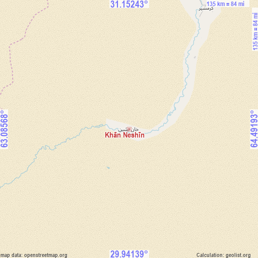
Khān Neshīn GPS coordinates[2]
30° 32' 55.68" North, 63° 47' 19.68" East
| Map corner | latitude | longitude |
|---|---|---|
| Upper-left | 31.15243°, | 63.08568° |
| Center: | 30.5488°, | 63.7888° |
| Lower-right: | 29.94139°, | 64.49193° |
| Map W x H: | 134.7×134.7 km | = 83.7×83.7mi |
| max Lat: | 38.4435° ⇑98.7% North |
| Khān Neshīn: | 30.5488° |
| min Lat: | ⇓1.3% South 30.15° |
| min Long | Khān Neshīn | max Long |
| 61.06667° | 63.7888° | 72.318° |
| W 12.2%⇐ | ⇒87.8% E |
Elevation
Elevation of Khān Neshīn is 635 m = 2083 ft, and this is 783.4 m = 2570 ft below average elevation for this country.
| Max E: |
3068 m = 10066 ft | 83.6% |
| Avg. | 1418.4 m = 4654 ft | |
| Khān Neshīn | 635 m = 2083 ft | |
Min E: |
254 m = 833 ft | 16.4% |
See also: Afghanistan elevation on elevation.city.
Geographical zone
Khān Neshīn is located in North temperate zone (between Tropic of Cancer and the Arctic Circle). Distance of this Northern Tropic circle is 790.8 km =491.4 mi to South.| Distance of | km | miles | from Khān Neshīn |
|---|---|---|---|
| North Pole | 6610.4 | 4107.5 | to North |
| Arctic Circle | 4004.5 | 2488.3 | to North |
| Tropic Cancer | 790.8 | 491.4 | to South |
| Equator | 3396.7 | 2110.6 | to South |


Nearby cities:
15 places around Khān Neshīn: (largest is in red/bold)
• Chinār
205.7 km =127.8 mi,  37°
37°
• Gereshk
159.8 km =99.3 mi,  27°
27°
• Khāsh
144.7 km =89.9 mi,  318°
318°
• Kishk-e Nakhūd
169.9 km =105.6 mi,  45°
45°
• Lashkar Gāh
128.8 km =80 mi, 25°
• Markaz-e Ḩukūmat-e Darwēshān
75.5 km =46.9 mi, 30°
• Markaz-e Ḩukūmat-e Sulţān-e Bakwāh
204.4 km =127 mi,  337°
337°
• Mīrābād
187.3 km =116.4 mi,  266°
266°
• Pāshmūl
192.7 km =119.7 mi, 54°
• Rūdbār
122.4 km =76.1 mi,  248°
248°
• Sangīn
196.5 km =122.1 mi, 30°
• Wāshēr
189.4 km =117.7 mi,  1°
1°
• Zaranj
189.8 km =117.9 mi,  283°
283°
• Ḩukūmat-e Nād ‘Alī
129 km =80.2 mi,  19°
19°
• ‘Alāqahdārī Dīshū
48.8 km =30.3 mi, 254°
Sources, notices
• [Note1] Compared only with cities in Afghanistan existing in our database
• [Src1] Map data: © OpenStreetMap contributors (CC-BY-SA)
• [Src2] Other city data from geonames.org with taken over terms of usage.
• [Src3] Geographical zone / Annual Mean Temperature by Robert A. Rohde @ Wikipedia
