Wāshēr geodata
Wāshēr (Helmand) is a seat of a second-order administrative division; located in Afghanistan in Asia/Kabul (GMT+4.5) time zone. In our database, there are 93 cities with bigger population. Compared to other cities in Afghanistan, 90.7% of cities are located further ↑North; 87.1% of cities are located further →East and 59.5% of cities have higher elevation than Wāshēr. Note1


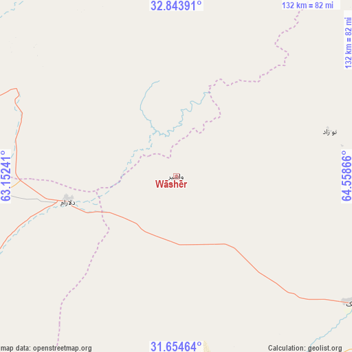
Wāshēr GPS coordinates[2]
32° 15' 4.392" North, 63° 51' 19.908" East
| Map corner | latitude | longitude |
|---|---|---|
| Upper-left | 32.84391°, | 63.15241° |
| Center: | 32.25122°, | 63.85553° |
| Lower-right: | 31.65464°, | 64.55866° |
| Map W x H: | 132.2×132.2 km | = 82.1×82.1mi |
| max Lat: | 38.4435° ⇑90.7% North |
| Wāshēr: | 32.25122° |
| min Lat: | ⇓9.3% South 30.15° |
| min Long | Wāshēr | max Long |
| 61.06667° | 63.85553° | 72.318° |
| W 12.9%⇐ | ⇒87.1% E |
Elevation
Elevation of Wāshēr is 1175 m = 3855 ft, and this is 243.4 m = 799 ft below average elevation for this country.
| Max E: |
3068 m = 10066 ft | 59.5% |
| Avg. | 1418.4 m = 4654 ft | |
| Wāshēr | 1175 m = 3855 ft | |
Min E: |
254 m = 833 ft | 40.5% |
See also: Afghanistan elevation on elevation.city.
Geographical zone
Wāshēr is located in North temperate zone (between Tropic of Cancer and the Arctic Circle). Distance of this Northern Tropic circle is 980.1 km =609 mi to South.| Distance of | km | miles | from Wāshēr |
|---|---|---|---|
| North Pole | 6421.1 | 3989.9 | to North |
| Arctic Circle | 3815.2 | 2370.7 | to North |
| Tropic Cancer | 980.1 | 609 | to South |
| Equator | 3586 | 2228.2 | to South |


Nearby cities:
15 places around Wāshēr: (largest is in red/bold)
• Chinār
120.7 km =75 mi,  102°
102°
• Dasht-e Qal‘ah
86.6 km =53.8 mi,  359°
359°
• Gereshk
82.6 km =51.3 mi,  125°
125°
• Khāsh
128.7 km =80 mi,  231°
231°
• Kishk-e Nakhūd
132.9 km =82.6 mi,  121°
121°
• Lashkar Gāh
87.8 km =54.6 mi,  146°
146°
• Markaz-e Ḩukūmat-e Darwēshān
128.5 km =79.8 mi,  165°
165°
• Markaz-e Ḩukūmat-e Sulţān-e Bakwāh
85.2 km =52.9 mi,  269°
269°
• Mūsá Qal‘ah
86.3 km =53.6 mi,  75°
75°
• Now Zād
60.1 km =37.3 mi,  73°
73°
• Qal‘ah-ye Kuhnah
44.2 km =27.5 mi,  336°
336°
• Sangīn
94.4 km =58.7 mi, 102°
• Taywarah
150.8 km =93.7 mi,  20°
20°
• Zīārat-e Shāh Maqşūd
155.2 km =96.4 mi, 101°
• Ḩukūmat-e Nād ‘Alī
76.7 km =47.7 mi, 151°
Sources, notices
• [Note1] Compared only with cities in Afghanistan existing in our database
• [Src1] Map data: © OpenStreetMap contributors (CC-BY-SA)
• [Src2] Other city data from geonames.org with taken over terms of usage.
• [Src3] Geographical zone / Annual Mean Temperature by Robert A. Rohde @ Wikipedia
