Markaz-e Ḩukūmat-e Sulţān-e Bakwāh geodata
Markaz-e Ḩukūmat-e Sulţān-e Bakwāh (Farah) is a seat of a second-order administrative division; located in Afghanistan in Asia/Kabul (GMT+4.5) time zone. In our database, there are 93 cities with bigger population. Compared to other cities in Afghanistan, 91% of cities are located further ↑North; 92% of cities are located further →East and 80.1% of cities have higher elevation than Markaz-e Ḩukūmat-e Sulţān-e Bakwāh. Note1
Current local time in Markaz-e Ḩukūmat-e Sulţān-e Bakwāh:
11:47 PM, TuesdayDifference from your time zone: hours


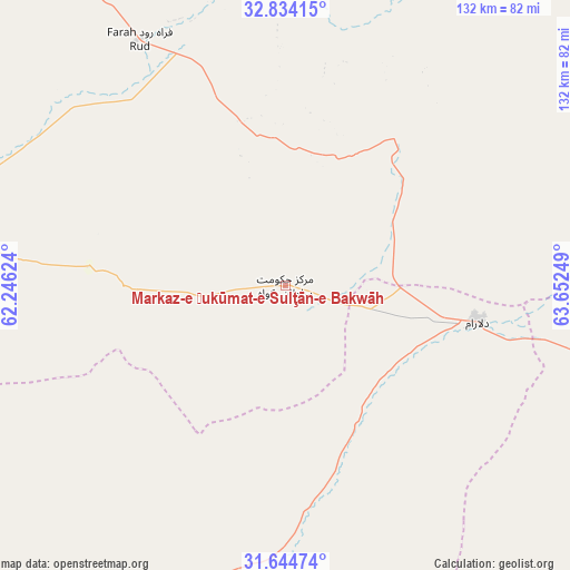
Markaz-e Ḩukūmat-e Sulţān-e Bakwāh GPS coordinates[2]
32° 14' 29.004" North, 62° 56' 57.696" East
| Map corner | latitude | longitude |
|---|---|---|
| Upper-left | 32.83415°, | 62.24624° |
| Center: | 32.24139°, | 62.94936° |
| Lower-right: | 31.64474°, | 63.65249° |
| Map W x H: | 132.2×132.2 km | = 82.1×82.1mi |
| max Lat: | 38.4435° ⇑91% North |
| Markaz-e Ḩukūmat-e Sulţān-e Bakwāh: | 32.24139° |
| min Lat: | ⇓9% South 30.15° |
| min Long | Markaz-e Ḩuk� | max Long |
| 61.06667° | 62.94936° | 72.318° |
| W 8%⇐ | ⇒92% E |
Elevation
Elevation of Markaz-e Ḩukūmat-e Sulţān-e Bakwāh is 724 m = 2375 ft, and this is 694.4 m = 2278 ft below average elevation for this country.
| Max E: |
3068 m = 10066 ft | 80.1% |
| Avg. | 1418.4 m = 4654 ft | |
| Markaz-e Ḩukūmat-e Sulţān-e Bakwāh | 724 m = 2375 ft | |
Min E: |
254 m = 833 ft | 19.9% |
See also: Afghanistan elevation on elevation.city.
Geographical zone
Markaz-e Ḩukūmat-e Sulţān-e Bakwāh is located in North temperate zone (between Tropic of Cancer and the Arctic Circle). Distance of this Northern Tropic circle is 979 km =608.3 mi to South.| Distance of | km | miles | from Markaz-e Ḩukūmat-e Sulţān-e Bakwāh |
|---|---|---|---|
| North Pole | 6422.2 | 3990.6 | to North |
| Arctic Circle | 3816.3 | 2371.3 | to North |
| Tropic Cancer | 979 | 608.3 | to South |
| Equator | 3584.9 | 2227.6 | to South |


Nearby cities:
15 places around Markaz-e Ḩukūmat-e Sulţān-e Bakwāh: (largest is in red/bold)
• Anār Darah
134.4 km =83.5 mi,  295°
295°
• Dasht-e Qal‘ah
121 km =75.2 mi,  43°
43°
• Dū Qal‘ah
141.8 km =88.1 mi,  265°
265°
• Farah
79.7 km =49.5 mi,  280°
280°
• Gereshk
159.8 km =99.3 mi,  107°
107°
• Khāsh
80.6 km =50.1 mi,  190°
190°
• Kushk
149.8 km =93.1 mi,  321°
321°
• Kushkak
134.3 km =83.5 mi, 272°
• Lashkar Gāh
152.3 km =94.6 mi,  118°
118°
• Lāsh-e Juwayn
138.2 km =85.9 mi,  244°
244°
• Now Zād
144 km =89.5 mi,  82°
82°
• Qal‘ah-ye Kuhnah
79.2 km =49.2 mi,  58°
58°
• Shīnḏanḏ
139.8 km =86.9 mi,  327°
327°
• Wāshēr
85.2 km =52.9 mi,  89°
89°
• Ḩukūmat-e Nād ‘Alī
138.8 km =86.2 mi, 118°
Sources, notices
• [Note1] Compared only with cities in Afghanistan existing in our database
• [Src1] Map data: © OpenStreetMap contributors (CC-BY-SA)
• [Src2] Other city data from geonames.org with taken over terms of usage.
• [Src3] Geographical zone / Annual Mean Temperature by Robert A. Rohde @ Wikipedia
