Ḩukūmat-e Nād ‘Alī geodata
Ḩukūmat-e Nād ‘Alī (Helmand) is a seat of a second-order administrative division; located in Afghanistan in Asia/Kabul (GMT+4.5) time zone. In our database, there are 93 cities with bigger population. Compared to other cities in Afghanistan, 95.2% of cities are located further ↑North; 85.9% of cities are located further →East and 76.2% of cities have higher elevation than Ḩukūmat-e Nād ‘Alī. Note1


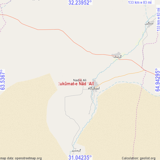
Ḩukūmat-e Nād ‘Alī GPS coordinates[2]
31° 38' 34.296" North, 64° 14' 23.352" East
| Map corner | latitude | longitude |
|---|---|---|
| Upper-left | 32.23952°, | 63.5367° |
| Center: | 31.64286°, | 64.23982° |
| Lower-right: | 31.04235°, | 64.94295° |
| Map W x H: | 133.1×133.1 km | = 82.7×82.7mi |
| max Lat: | 38.4435° ⇑95.2% North |
| Ḩukūmat-e Nād ‘Alī: | 31.64286° |
| min Lat: | ⇓4.8% South 30.15° |
| min Long | Ḩukūmat-e N� | max Long |
| 61.06667° | 64.23982° | 72.318° |
| W 14.1%⇐ | ⇒85.9% E |
Elevation
Elevation of Ḩukūmat-e Nād ‘Alī is 797 m = 2615 ft, and this is 621.4 m = 2039 ft below average elevation for this country.
| Max E: |
3068 m = 10066 ft | 76.2% |
| Avg. | 1418.4 m = 4654 ft | |
| Ḩukūmat-e Nād ‘Alī | 797 m = 2615 ft | |
Min E: |
254 m = 833 ft | 23.8% |
See also: Afghanistan elevation on elevation.city.
Geographical zone
Ḩukūmat-e Nād ‘Alī is located in North temperate zone (between Tropic of Cancer and the Arctic Circle). Distance of this Northern Tropic circle is 912.4 km =566.9 mi to South.| Distance of | km | miles | from Ḩukūmat-e Nād ‘Alī |
|---|---|---|---|
| North Pole | 6488.7 | 4031.9 | to North |
| Arctic Circle | 3882.8 | 2412.7 | to North |
| Tropic Cancer | 912.4 | 566.9 | to South |
| Equator | 3518.4 | 2186.2 | to South |


Nearby cities:
15 places around Ḩukūmat-e Nād ‘Alī: (largest is in red/bold)
• Babasakhib
134.5 km =83.6 mi,  89°
89°
• Chinār
91.8 km =57 mi,  63°
63°
• Gereshk
37 km =23 mi, 57°
• Khān Neshīn
129 km =80.2 mi,  199°
199°
• Khāsh
137.9 km =85.7 mi,  264°
264°
• Kishk-e Nakhūd
77.2 km =48 mi, 91°
• Lashkar Gāh
13.6 km =8.5 mi,  113°
113°
• Markaz-e Ḩukūmat-e Darwēshān
56.9 km =35.4 mi,  184°
184°
• Mūsá Qal‘ah
101.2 km =62.9 mi,  28°
28°
• Now Zād
87.3 km =54.2 mi,  14°
14°
• Pāshmūl
113.5 km =70.5 mi, 94°
• Qal‘ah-ye Kuhnah
120.9 km =75.1 mi,  333°
333°
• Sangīn
73.8 km =45.9 mi,  49°
49°
• Wāshēr
76.7 km =47.7 mi, 331°
• Zīārat-e Shāh Maqşūd
122.6 km =76.2 mi,  71°
71°
Sources, notices
• [Note1] Compared only with cities in Afghanistan existing in our database
• [Src1] Map data: © OpenStreetMap contributors (CC-BY-SA)
• [Src2] Other city data from geonames.org with taken over terms of usage.
• [Src3] Geographical zone / Annual Mean Temperature by Robert A. Rohde @ Wikipedia
