Markaz-e Ḩukūmat-e Darwēshān geodata
Markaz-e Ḩukūmat-e Darwēshān (Helmand) is a populated place; located in Afghanistan in Asia/Kabul (GMT+4.5) time zone. With population of 9,012 people, there are 74 cities with bigger population in this country. Compared to other cities in Afghanistan, 97.7% of cities are located further ↑North; 86.2% of cities are located further →East and 80.7% of cities have higher elevation than Markaz-e Ḩukūmat-e Darwēshān. Note1
Current local time in Markaz-e Ḩukūmat-e Darwēshān:
01:39 AM, WednesdayDifference from your time zone: hours


Markaz-e Ḩukūmat-e Darwēshān GPS coordinates[2]
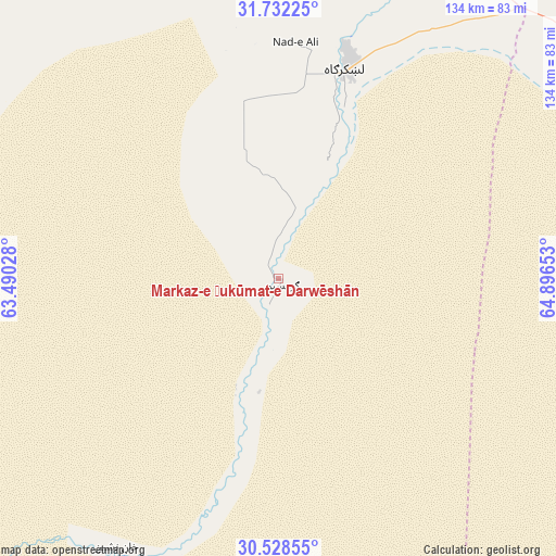
31° 7' 56.316" North, 64° 11' 36.24" East
| Map corner | latitude | longitude |
|---|---|---|
| Upper-left | 31.73225°, | 63.49028° |
| Center: | 31.13231°, | 64.1934° |
| Lower-right: | 30.52855°, | 64.89653° |
| Map W x H: | 133.8×133.8 km | = 83.1×83.1mi |
| max Lat: | 38.4435° ⇑97.7% North |
| Markaz-e Ḩukūmat-e Darwēshān: | 31.13231° |
| min Lat: | ⇓2.3% South 30.15° |
| min Long | Markaz-e Ḩuk� | max Long |
| 61.06667° | 64.1934° | 72.318° |
| W 13.8%⇐ | ⇒86.2% E |
Elevation
Elevation of Markaz-e Ḩukūmat-e Darwēshān is 714 m = 2343 ft, and this is 704.4 m = 2311 ft below average elevation for this country.
| Max E: |
3068 m = 10066 ft | 80.7% |
| Avg. | 1418.4 m = 4654 ft | |
| Markaz-e Ḩukūmat-e Darwēshān | 714 m = 2343 ft | |
Min E: |
254 m = 833 ft | 19.3% |
See also: Afghanistan elevation on elevation.city.
Geographical zone
Markaz-e Ḩukūmat-e Darwēshān is located in North temperate zone (between Tropic of Cancer and the Arctic Circle). Distance of this Northern Tropic circle is 855.7 km =531.7 mi to South.| Distance of | km | miles | from Markaz-e Ḩukūmat-e Darwēshān |
|---|---|---|---|
| North Pole | 6545.5 | 4067.2 | to North |
| Arctic Circle | 3939.6 | 2448 | to North |
| Tropic Cancer | 855.7 | 531.7 | to South |
| Equator | 3461.6 | 2150.9 | to South |


Nearby cities:
15 places around Markaz-e Ḩukūmat-e Darwēshān: (largest is in red/bold)
• Babasakhib
151.2 km =94 mi,  67°
67°
• Chinār
130.9 km =81.3 mi,  41°
41°
• Gereshk
84.5 km =52.5 mi,  25°
25°
• Kandahār
153.6 km =95.4 mi, 69°
• Khān Neshīn
75.5 km =46.9 mi,  210°
210°
• Khāsh
140.4 km =87.2 mi,  288°
288°
• Kishk-e Nakhūd
98.5 km =61.2 mi,  56°
56°
• Lashkar Gāh
54 km =33.6 mi,  18°
18°
• Now Zād
143.7 km =89.3 mi,  10°
10°
• Pāshmūl
127 km =78.9 mi, 68°
• Sangīn
121 km =75.2 mi, 30°
• Wāshēr
128.5 km =79.8 mi,  345°
345°
• Zīārat-e Shāh Maqşūd
153.9 km =95.6 mi,  51°
51°
• Ḩukūmat-e Nād ‘Alī
56.9 km =35.4 mi,  4°
4°
• ‘Alāqahdārī Dīshū
115.7 km =71.9 mi,  227°
227°
Sources, notices
• [Note1] Compared only with cities in Afghanistan existing in our database
• [Src1] Map data: © OpenStreetMap contributors (CC-BY-SA)
• [Src2] Other city data from geonames.org with taken over terms of usage.
• [Src3] Geographical zone / Annual Mean Temperature by Robert A. Rohde @ Wikipedia
