Mīrābād geodata
Mīrābād (Nimroz) is a populated place; located in Afghanistan in Asia/Kabul (GMT+4.5) time zone. With population of 14,160 people, there are 49 cities with bigger population in this country. Compared to other cities in Afghanistan, 99% of cities are located further ↑North; 96.8% of cities are located further →East and 87.1% of cities have higher elevation than Mīrābād. Note1


Mīrābād GPS coordinates[2]
30° 26' 10.464" North, 61° 50' 17.88" East
| Map corner | latitude | longitude |
|---|---|---|
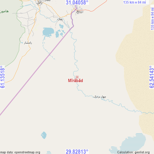
| Upper-left | 31.04058°, | 61.13518° |
| Center: | 30.43624°, | 61.8383° |
| Lower-right: | 29.82813°, | 62.54143° |
| Map W x H: | 134.8×134.8 km | = 83.8×83.8mi |
| max Lat: | 38.4435° ⇑99% North |
| Mīrābād: | 30.43624° |
| min Lat: | ⇓1% South 30.15° |
| min Long | Mīrābād | max Long |
| 61.06667° | 61.8383° | 72.318° |
| W 3.2%⇐ | ⇒96.8% E |
Elevation
Elevation of Mīrābād is 514 m = 1686 ft, and this is 904.4 m = 2967 ft below average elevation for this country.
| Max E: |
3068 m = 10066 ft | 87.1% |
| Avg. | 1418.4 m = 4654 ft | |
| Mīrābād | 514 m = 1686 ft | |
Min E: |
254 m = 833 ft | 12.9% |
See also: Afghanistan elevation on elevation.city.
Geographical zone
Mīrābād is located in North temperate zone (between Tropic of Cancer and the Arctic Circle). Distance of this Northern Tropic circle is 778.3 km =483.6 mi to South.| Distance of | km | miles | from Mīrābād |
|---|---|---|---|
| North Pole | 6622.9 | 4115.3 | to North |
| Arctic Circle | 4017 | 2496 | to North |
| Tropic Cancer | 778.3 | 483.6 | to South |
| Equator | 3384.2 | 2102.8 | to South |


Nearby cities:
15 places around Mīrābād: (largest is in red/bold)
• Anār Darah
258.8 km =160.8 mi,  356°
356°
• Dū Qal‘ah
193.3 km =120.1 mi,  348°
348°
• Farah
217.1 km =134.9 mi,  6°
6°
• Khān Neshīn
187.3 km =116.4 mi,  86°
86°
• Khāsh
151.7 km =94.3 mi,  36°
36°
• Kushkak
208.3 km =129.4 mi, 351°
• Lashkar Gāh
273.6 km =170 mi,  61°
61°
• Lāsh-e Juwayn
143.5 km =89.2 mi, 351°
• Markaz-e Ḩukūmat-e Darwēshān
237.9 km =147.8 mi,  71°
71°
• Markaz-e Ḩukūmat-e Sulţān-e Bakwāh
226.8 km =140.9 mi,  27°
27°
• Rūdbār
79.8 km =49.6 mi,  113°
113°
• Wāshēr
278.2 km =172.9 mi, 43°
• Zaranj
58.2 km =36.2 mi,  2°
2°
• Ḩukūmat-e Nād ‘Alī
265.2 km =164.8 mi, 59°
• ‘Alāqahdārī Dīshū
139.9 km =86.9 mi, 90°
Sources, notices
• [Note1] Compared only with cities in Afghanistan existing in our database
• [Src1] Map data: © OpenStreetMap contributors (CC-BY-SA)
• [Src2] Other city data from geonames.org with taken over terms of usage.
• [Src3] Geographical zone / Annual Mean Temperature by Robert A. Rohde @ Wikipedia
