Maningrida geodata
Maningrida (Northern Territory) is a populated place; located in Australia in Australia/Darwin (GMT+9.5) time zone. With population of 2,325 people, there are 2676 cities with bigger population in this country. Compared to other cities in Australia, 99.9% of cities are located further ↓South; 86.4% of cities are located further →East and 74.7% of cities have higher elevation than Maningrida. Note1


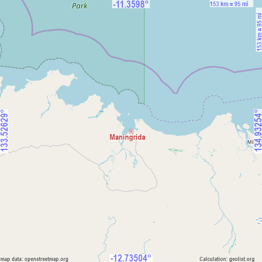
Maningrida GPS coordinates[2]
12° 2' 53.88" South, 134° 13' 45.876" East
| Map corner | latitude | longitude |
|---|---|---|
| Upper-left | -11.3598°, | 133.52629° |
| Center: | -12.0483°, | 134.22941° |
| Lower-right: | -12.73504°, | 134.93254° |
| Map W x H: | 152.9×152.9 km | = 95×95mi |
| max Lat: | -10.58257° ⇑0.1% North |
| Maningrida: | -12.0483° |
| min Lat: | ⇓99.9% South -43.31423° |
| min Long | Maningrida | max Long |
| 113.53327° | 134.22941° | 153.61246° |
| W 13.6%⇐ | ⇒86.4% E |
Elevation
Elevation of Maningrida is 19 m = 62 ft, and this is 103 m = 338 ft below average elevation for this country.
| Max E: |
1715 m = 5627 ft | 74.7% |
| Avg. | 122 m = 400 ft | |
| Maningrida | 19 m = 62 ft | |
Min E: |
-2 m = -7 ft | 25.3% |
See also: Australia elevation on elevation.city.
Geographical zone
Maningrida is located in South Torrid zone (between Equator and Tropic of Capricorn). Distance of this Southern Tropic circle is 1266.3 km =786.8 mi to South.| Distance of | km | miles | from Maningrida |
|---|---|---|---|
| Equator | 1339.6 | 832.4 | to North |
| Tropic Capricorn | 1266.3 | 786.8 | to South |
| Antarctic Circle | 6061.5 | 3766.4 | to South |
| South Pole | 8667.4 | 5385.7 | to South |


Nearby cities:
15 places around Maningrida: (largest is in red/bold)
• Alyangula
311 km =193.2 mi,  130°
130°
• Beswick
304 km =188.9 mi,  203°
203°
• Galiwinku
145.2 km =90.2 mi,  89°
89°
• Gapuwiyak
179.1 km =111.3 mi,  106°
106°
• Gunbalanya
131.7 km =81.8 mi,  256°
256°
• Jabiru
166.4 km =103.4 mi,  245°
245°
• Kakadu
211.3 km =131.3 mi,  244°
244°
• Lansdowne
331.6 km =206 mi,  216°
216°
• Marrakai
308.6 km =191.8 mi, 255°
• Milingimbi
75.2 km =46.7 mi, 94°
• Ngukurr
303.2 km =188.4 mi,  169°
169°
• Nhulunbuy
277.5 km =172.4 mi, 93°
• Ramingining
82.6 km =51.3 mi, 112°
• West Arnhem
27.7 km =17.2 mi, 221°
• Yirrkala
290.1 km =180.3 mi, 94°
Sources, notices
• [Note1] Compared only with cities in Australia existing in our database
• [Src1] Map data: © OpenStreetMap contributors (CC-BY-SA)
• [Src2] Other city data from geonames.org with taken over terms of usage.
• [Src3] Geographical zone / Annual Mean Temperature by Robert A. Rohde @ Wikipedia
