Milingimbi geodata
Milingimbi (Northern Territory) is a populated place; located in Australia in Australia/Darwin (GMT+9.5) time zone. With population of 1,279 people, there are 3491 cities with bigger population in this country. Compared to other cities in Australia, 99.8% of cities are located further ↓South; 86.3% of cities are located further →East and 91.8% of cities have higher elevation than Milingimbi. Note1


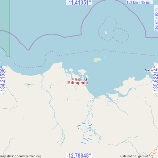
Milingimbi GPS coordinates[2]
12° 6' 6.768" South, 134° 55' 8.436" East
| Map corner | latitude | longitude |
|---|---|---|
| Upper-left | -11.41351°, | 134.21589° |
| Center: | -12.10188°, | 134.91901° |
| Lower-right: | -12.78848°, | 135.62214° |
| Map W x H: | 152.9×152.9 km | = 95×95mi |
| max Lat: | -10.58257° ⇑0.2% North |
| Milingimbi: | -12.10188° |
| min Lat: | ⇓99.8% South -43.31423° |
| min Long | Milingimbi | max Long |
| 113.53327° | 134.91901° | 153.61246° |
| W 13.7%⇐ | ⇒86.3% E |
Elevation
Elevation of Milingimbi is 8 m = 26 ft, and this is 114 m = 374 ft below average elevation for this country.
| Max E: |
1715 m = 5627 ft | 91.8% |
| Avg. | 122 m = 400 ft | |
| Milingimbi | 8 m = 26 ft | |
Min E: |
-2 m = -7 ft | 8.2% |
See also: Australia elevation on elevation.city.
Geographical zone
Milingimbi is located in South Torrid zone (between Equator and Tropic of Capricorn). Distance of this Southern Tropic circle is 1260.3 km =783.1 mi to South.| Distance of | km | miles | from Milingimbi |
|---|---|---|---|
| Equator | 1345.6 | 836.1 | to North |
| Tropic Capricorn | 1260.3 | 783.1 | to South |
| Antarctic Circle | 6055.6 | 3762.8 | to South |
| South Pole | 8661.5 | 5382 | to South |


Nearby cities:
15 places around Milingimbi: (largest is in red/bold)
• Alyangula
253.9 km =157.8 mi,  140°
140°
• Beswick
335.7 km =208.6 mi,  215°
215°
• Galiwinku
70.7 km =43.9 mi,  83°
83°
• Gapuwiyak
106.6 km =66.2 mi,  114°
114°
• Gunbalanya
204.5 km =127.1 mi,  263°
263°
• Jabiru
234.9 km =146 mi,  254°
254°
• Kakadu
278.8 km =173.2 mi, 252°
• Maningrida
75.2 km =46.7 mi,  274°
274°
• Mataranka
372.1 km =231.2 mi,  212°
212°
• Miniyeri
358.9 km =223 mi,  194°
194°
• Ngukurr
293 km =182.1 mi,  183°
183°
• Nhulunbuy
202.3 km =125.7 mi,  92°
92°
• Ramingining
25.6 km =15.9 mi, 176°
• West Arnhem
94.5 km =58.7 mi, 260°
• Yirrkala
214.9 km =133.5 mi, 94°
Sources, notices
• [Note1] Compared only with cities in Australia existing in our database
• [Src1] Map data: © OpenStreetMap contributors (CC-BY-SA)
• [Src2] Other city data from geonames.org with taken over terms of usage.
• [Src3] Geographical zone / Annual Mean Temperature by Robert A. Rohde @ Wikipedia
