Murtoa geodata
Murtoa (Victoria) is a populated place; located in Australia in Australia/Melbourne (GMT+11) time zone. With population of 851 people, there are 4060 cities with bigger population in this country. Compared to other cities in Australia, 80.2% of cities are located further ↑North; 74.3% of cities are located further →East and 76.3% of cities have lower elevation than Murtoa. Note1


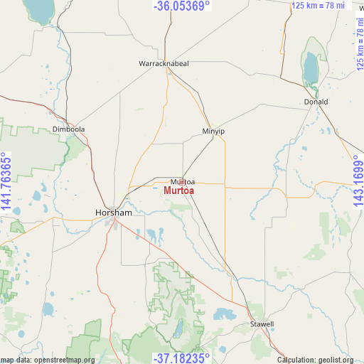
Murtoa GPS coordinates[2]
36° 37' 12.324" South, 142° 28' 0.372" East
| Map corner | latitude | longitude |
|---|---|---|
| Upper-left | -36.05369°, | 141.76365° |
| Center: | -36.62009°, | 142.46677° |
| Lower-right: | -37.18235°, | 143.1699° |
| Map W x H: | 125.5×125.5 km | = 78×78mi |
| max Lat: | -10.58257° ⇑80.2% North |
| Murtoa: | -36.62009° |
| min Lat: | ⇓19.8% South -43.31423° |
| min Long | Murtoa | max Long |
| 113.53327° | 142.46677° | 153.61246° |
| W 25.7%⇐ | ⇒74.3% E |
Elevation
Elevation of Murtoa is 141 m = 463 ft, and this is 19 m = 62 ft above average elevation for this country.
| Max E: |
1715 m = 5627 ft | 23.7% |
| Murtoa | 141 m 463 ft | |
| Avg. | 122 m = 400 ft | |
Min E: |
-2 m = -7 ft | 76.3% |
See also: Australia elevation on elevation.city.
Geographical zone
Murtoa is located in South temperate zone (between Tropic of Capricorn and the Antarctic Circle). Distance of this Southern Tropic circle is 1465.9 km =910.9 mi to North.| Distance of | km | miles | from Murtoa |
|---|---|---|---|
| Equator | 4071.8 | 2530.1 | to North |
| Tropic Capricorn | 1465.9 | 910.9 | to North |
| Antarctic Circle | 3329.4 | 2068.8 | to South |
| South Pole | 5935.3 | 3688 | to South |


Nearby cities:
15 places around Murtoa: (largest is in red/bold)
• Ararat
84.5 km =52.5 mi,  151°
151°
• Birchip
81.5 km =50.6 mi,  29°
29°
• Charlton
88.3 km =54.9 mi,  63°
63°
• Dimboola
42.8 km =26.6 mi,  295°
295°
• Donald
53.8 km =33.4 mi, 58°
• Halls Gap
58.7 km =36.5 mi,  175°
175°
• Haven
28.9 km =18 mi,  237°
237°
• Hopetoun
99.7 km =62 mi,  354°
354°
• Horsham
25.9 km =16.1 mi,  246°
246°
• Nhill
79.7 km =49.5 mi,  293°
293°
• Rainbow
90.8 km =56.4 mi,  332°
332°
• Rupanyup
14.7 km =9.1 mi,  93°
93°
• Stawell
56 km =34.8 mi, 150°
• Warracknabeal
41.3 km =25.7 mi, 350°
• Wycheproof
91 km =56.5 mi,  48°
48°
Sources, notices
• [Note1] Compared only with cities in Australia existing in our database
• [Src1] Map data: © OpenStreetMap contributors (CC-BY-SA)
• [Src2] Other city data from geonames.org with taken over terms of usage.
• [Src3] Geographical zone / Annual Mean Temperature by Robert A. Rohde @ Wikipedia
