Shakawe geodata
Shakawe (North-West) is a populated place; located in Botswana in Africa/Gaborone (GMT+2) time zone. With population of 5,651 people, there are 26 cities with bigger population in this country. Compared to other cities in Botswana, 97.1% of cities are located further ↓South; 93.3% of cities are located further →East and 51.4% of cities have lower elevation than Shakawe. Note1


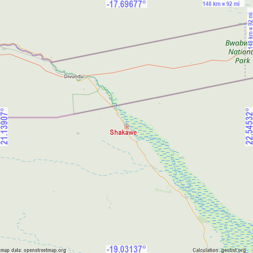
Shakawe GPS coordinates[2]
18° 21' 55.296" South, 21° 50' 31.884" East
| Map corner | latitude | longitude |
|---|---|---|
| Upper-left | -17.69677°, | 21.13907° |
| Center: | -18.36536°, | 21.84219° |
| Lower-right: | -19.03137°, | 22.54532° |
| Map W x H: | 148.4×148.4 km | = 92.2×92.2mi |
| max Lat: | -17.80165° ⇑2.9% North |
| Shakawe: | -18.36536° |
| min Lat: | ⇓97.1% South -26.9° |
| min Long | Shakawe | max Long |
| 20.06667° | 21.84219° | 28.74946° |
| W 6.7%⇐ | ⇒93.3% E |
Elevation
Elevation of Shakawe is 1000 m = 3281 ft, and this is 15 m = 49 ft below average elevation for this country.
| Max E: |
1406 m = 4613 ft | 48.6% |
| Avg. | 1015 m = 3330 ft | |
| Shakawe | 1000 m = 3281 ft | |
Min E: |
676 m = 2218 ft | 51.4% |
See also: Botswana elevation on elevation.city.
Geographical zone
Shakawe is located in South Torrid zone (between Equator and Tropic of Capricorn). Distance of this Southern Tropic circle is 563.9 km =350.4 mi to South.| Distance of | km | miles | from Shakawe |
|---|---|---|---|
| Equator | 2042 | 1268.8 | to North |
| Tropic Capricorn | 563.9 | 350.4 | to South |
| Antarctic Circle | 5359.1 | 3330 | to South |
| South Pole | 7965 | 4949.2 | to South |


Nearby cities:
13 places around Shakawe: (largest is in red/bold)
• Dekar
352.4 km =219 mi,  178°
178°
• Ghanzi
371.1 km =230.6 mi, 183°
• Gweta
409.3 km =254.3 mi,  119°
119°
• Kachikau
278 km =172.7 mi,  85°
85°
• Kasane
356.3 km =221.4 mi,  79°
79°
• Kavimba
293.9 km =182.6 mi, 82°
• Maun
244.3 km =151.8 mi,  137°
137°
• Nokaneng
151.4 km =94.1 mi,  162°
162°
• Pandamatenga
399.6 km =248.3 mi, 92°
• Rakops
396 km =246.1 mi, 138°
• Sehithwa
251 km =156 mi, 158°
• Toteng
252.7 km =157 mi,  152°
152°
• Tsau
208.4 km =129.5 mi, 162°
Sources, notices
• [Note1] Compared only with cities in Botswana existing in our database
• [Src1] Map data: © OpenStreetMap contributors (CC-BY-SA)
• [Src2] Other city data from geonames.org with taken over terms of usage.
• [Src3] Geographical zone / Annual Mean Temperature by Robert A. Rohde @ Wikipedia
